


Summit: Mount Carrigain (4,700')
Trail route: Sawyer River Road, Signal Ridge Trail
Trail conditions: Solid snowpack with a thin coating of new snow and minor drifting below Signal Ridge
Weather: Cold temps and cold wind on the summit, full sunshine to afternoon cloud cover
Total miles: 13.6
Total time: 7:25
I needed one more hike for one more summit to grid out February which means I will have hiked all 48 4,000 footers in this month. With tolerable weather and trail conditions I would be hiking to Mount Carrigain today to also grid out that summit meaning to hike it in every month of the year. If not today then I would probably not get it done this month with two snowstorms and much colder temperatures in the forecast.
I was the first one in the parking lot this morning. This hike requires a two mile road walk to the trailhead on the unplowed Sawyer River Road in winter. The road is heavily used by snowmobiles and was well packed down. I met no snowmobiles on the walk to the trailhead this morning.
I put on microspikes when I got to the trailhead, this was the right traction since the trail was frozen snowpack with just a light coating of snow from last night. As I got a mile into the trail there were lots of what looked like coyote tracks then large fresh scat, I kept my eyes peeled because this was very recent activity. I reached my least favorite part of the trail on this hike, a long relentless upward climb. Just below Signal Ridge there was some drifting on the trail but easily handled with the microspikes.
There was a cold wind up on Signal Ridge. It only got much colder and windier on the summit. I dropped my pack and climbed up the summit tower. I stayed just long enough for a few pics and video then back down below the tower for a selfie. This was long enough on the summit and I started my descent. It was a good hike back down to the trailhead. I had met no other hikers on the trail today.
There was lots of snowmobile activity on the road walk back to the parking lot. I kept to the side of the road to prevent any mishaps. I met two hikers coming up the road and that would be the only ones for today. Back at the parking lot there were several vehicles and I have no idea where these people might have gone since I only saw two hikers on the road.
I was very glad to get this hike done today. My next big grid hike will be next month. That will grid out the Bonds and March. I am hoping for good weather and great trail conditions for that hike!
Enjoy the photos and video!

The hike starts here

Sawyer River Road

Sun coming up

At the trailhead after a two mile road walk

Whiteface Brook

Lots of coyote tracks on the trail then this fresh scat

First water crossing

Second water crossing

Third water crossing

The long relentless up

Deep posthole on the side of the trail

First view from Signal Ridge

Summit up ahead

Summit tower

Vose Spur

Mount Lowell

No-fall zone on Signal Ridge

Arriving at the summit

Signal Ridge from the summit
View from the tower

West view from the tower

Lincoln and Lafayette

Snowy Presidential summits

Beginning the descent

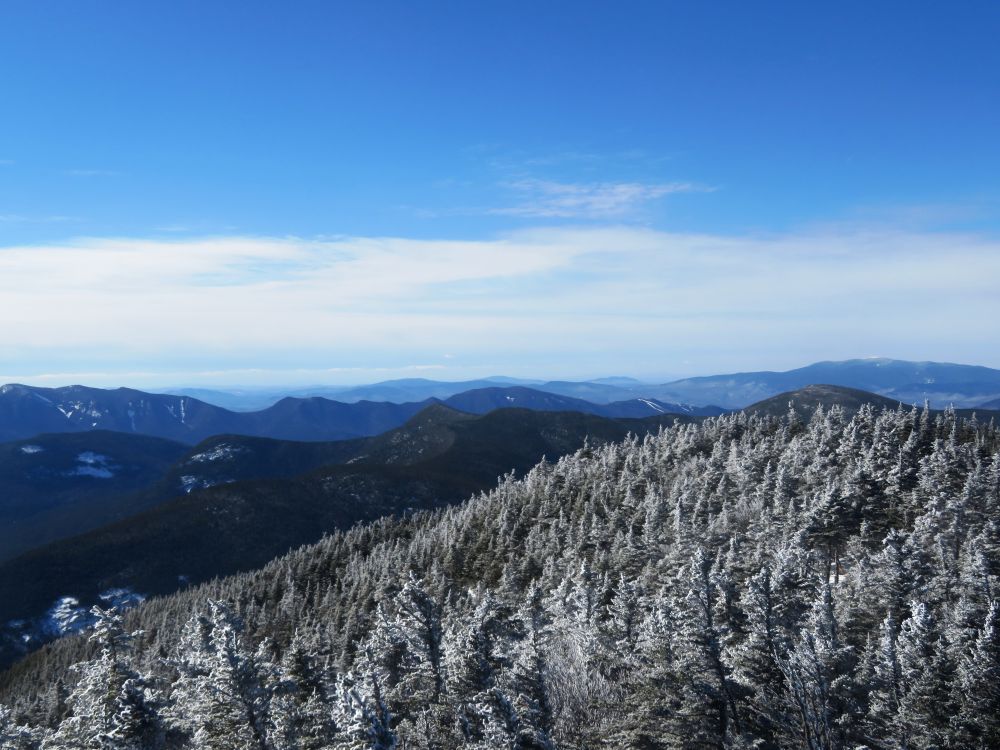
Frosty treetops and blue sky

Crossing back over Signal Ridge

Mount Chocorua

Mount Washington summit cone

Back at the trailhead and two more miles to the parking lot

At the end of the road and end of the hike after 13.6 miles
Having Fun in the Great Outdoors!
Awesome 🤩 Congratulations.
ReplyDelete