


Summits: None
Trail route: Valley Way, Gulfside Trail, Westside Trail, Crawford Path, Crawford Connector
Trail conditions: Mostly dry with a few patches of mud and wetness
Weather: Cool start (briefly), then warm, cooling wind above treeline, hot and muggy on the final descent, lots of sunshine all day
Total miles: 18
Total time: 15:30
For the past several months some of us have bandied around the idea of doing a Presidential traverse without summiting any of the peaks along the way. Today was the day I would be joining Amy, Jill and Kally to participate in this hiking adventure.
With an on trail start time of 5:00 AM I decided to stay at Dolly Copp Campground the night before which put me a little closer to the trailhead. I also wanted to use my truck cap camper that I built so I could continue adjusting and improving any areas that needed some tweaking. It was a beautiful night at Dolly Copp with cool temps and no bugs.
Early the next morning I arrived at the Appalachia parking lot just before 5:00 AM and found it full. That meant I had to park beside busy Route 2, vehicles were already lining the highway and hikers continued to arrive. Amy, Kally and Jill were already there and we were soon on the Valley Way trail.
It was a cool start but quickly warmed up as the sun was rising. Not far up the trail we met hiking couple Sam and Shannon as they passed by us. They were doing a Presi traverse including the summits. We would continue to see them throughout the day. There were many more hikers along the way and many were doing the Presi traverse.
We arrived at Madison Spring Hut and took a nice break. There were leftover pancakes that were free for the taking, they were quite delicious and provided a nice little boost in energy. I put on my first layer of sunscreen knowing there would be full sun exposure with very little shade for most of the day above treeline. We then departed the hut and made our way up the Gulfside Trail.
It was nice to bypass Mount Madison and then skirt around the summit of Mount Adams. We saw a lot of hikers coming and going at Thunderstorm Junction. As we continued around a bend in the trail we could see the upcoming high summits were covered in a layer of clouds. It was actually nice to have some temporary cloud cover from the blazing sun.
There was a nice refreshing breeze above treeline but after dipping down into Edmands Col and climbing up toward Mount Jefferson the wind diminished and the sun was beating down on us creating a hot ascent. We took a short break at the trail junction to the summit of Jefferson. We then continued on bypassing the summit.
When we got past Mount Jefferson we stopped for lunch on some rocks just past Monticello Lawn. There was a cool breeze blowing and I really needed that lunch break. Feeling revived after eating, resting and cooling down we were ready to continue. Our next ascent was alongside Mount Clay. This is a gradual but relentless climb under a glaring sun today as we bypassed the summit of Clay.
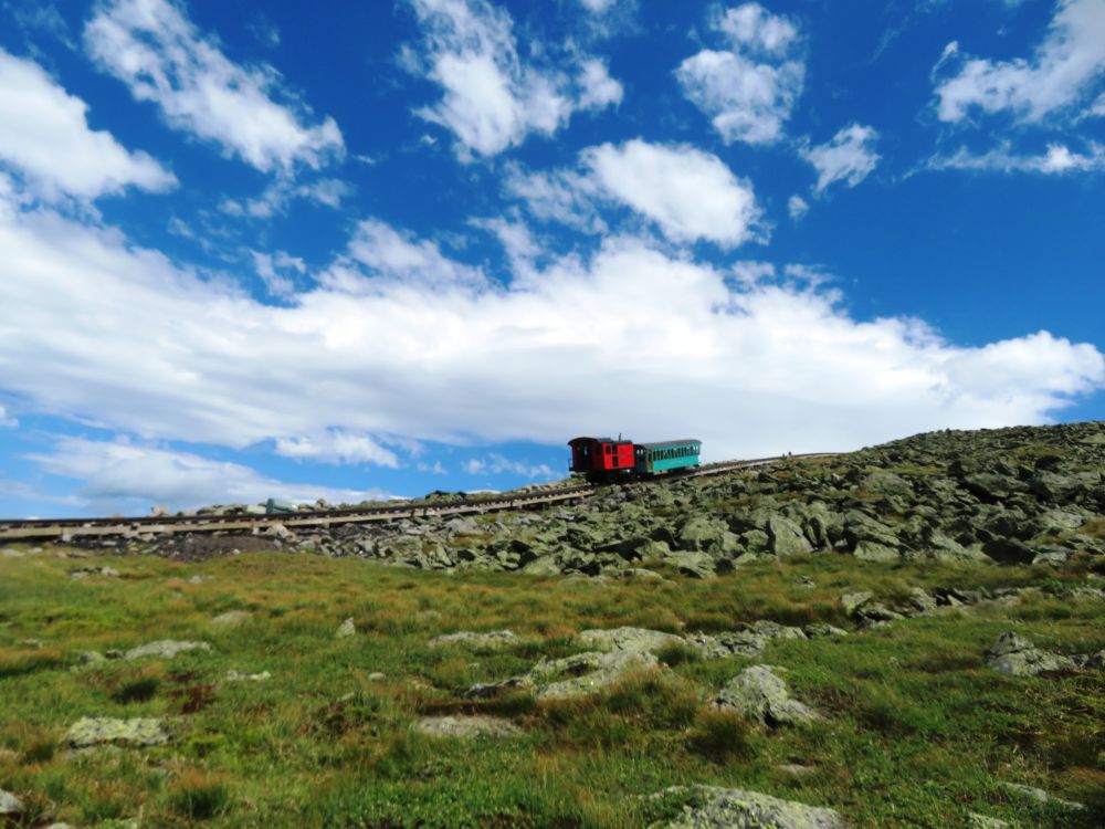
Mount Washington loomed ahead as we continued to Westside Trail. This trail loops around the summit cone of Washington. We first walked under the cog tracks as many trains were ascending and descending. This marked the halfway point of our hike today. We bypassed the summit of Washington on the Westside Trail and it brought us to the Crawford Path, the final trail to the parking lot.
Our next stop was at the Lakes-of-the-Clouds Hut. It was here that we contemplated ending our Presi traverse, all of us exhausted, hot and hurting. There was also the possibility of descending Edmands Path when we got to Mount Eisenhower. But we figured it would be a stifling hot and long road walk back to the Mt. Clinton Road parking area. We did have a cool breeze up here above treeline so after a snack and some brief rest we overcame our moment of weakness and it was unanimous that we continue on all the way to Pierce then down.
We bypassed Mount Monroe and enjoyed a nice stretch of trail that bypassed Mount Franklin. It was then around Mount Eisenhower on a section of trail that none of us enjoyed. We dropped down into the col between Ike and Pierce with one more ascent to the Webster Cliff Trail junction. We had several encounters with Sam and Shannon across the Presidential traverse leapfrogging with them along the way. This would be the last time we would see them before the final descent of the day, it was a pleasure meeting them!
It got very warm and humid on the way down. The sun was setting but it didn't help to cool the temperature and there was no wind or even a slight breeze. We arrived at the Mt. Clinton Road parking area from the Appalachia parking area after 18 miles and 15.5 hours. I was very glad to be able to join three tough, seasoned hikers for this traverse and we all felt a great sense of accomplishment after completing this epic hike!
Enjoy the photos and video from this extraordinary adventure!

Ready to go at 5:00 AM

Here comes the sun and warm temps

Spider web with spider in the middle of a trail we didn't need to take

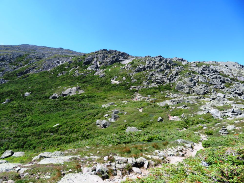
Mount Madison

Madison Spring Hut

Bang a Gong


A look back at the first peak we bypassed...Mount Madison

On the Gulfside Trail


Above King Ravine

Crag Camp
 A view down into King Ravine
Working our way around Mount Adams

Puffy clouds

Sandwort

At Thunderstorm Junction

Bypassing our second summit...Mount Adams

Summits in the clouds ahead of us but not for long

Watery stretch

A look back at Mount Adams


Approaching Mount Jefferson
Got to get over those rocks up ahead


A rocky hot stretch of the Gulfside Trail

Bypassing Mount Jefferson

A nice flat level section of the Gulfside Trail

A look back at Mount Jefferson in the distance

A view down Burt Ravine

Marshfield Station

Two cog trains descending

On the trail below the summit of Mount Clay

More mountains to go around in the distance

A look back at mountains we have already gone around

Cog train coming up


Amy crosses under the cog tracks


Busy bees

On the Westside Trail below the summit of Mount Washington

Lakes of the Clouds Hut below Mount Monroe

Jill about to leave the Westside Trail

Amy and Kally enjoying the Westside Trail

Arriving at Lakes of the Clouds

A look back at Mount Washington from Lakes of the Clouds

Bypassing Mount Monroe

Onward to Mount Franklin

Kally pauses to enjoy the views
Amy and Jill enjoy a flat smooth section of trail

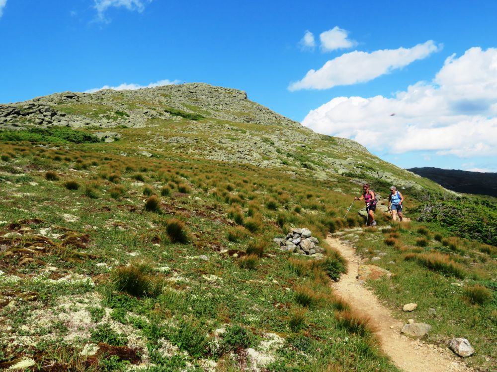
Summit cairn can be seen on Mount Eisenhower up ahead

Mount Washington can be seen between Little Monroe and Mount Monroe

Mount Eisenhower up ahead

The Old Man of Mount Eisenhower

Bypassing Mount Eisenhower

Meadowsweet

Heading toward Mount Pierce

Bog bridge

Eisenhower Monroe and Washington

View from below the summit of Mount Pierce

Bridge over Gibbs Brook

The hike ends here after 18 miles and 15.5 hours

Some of the summits that we went around on this Presidential traverse
Having Fun in the Great Outdoors!
Don ~ this was a trek of accomplishments & adventure together and I’m thankful for having had the day in the mountains, on the mountains, & no summits with you, Amy & Jill!
ReplyDeleteKally - an epic hike for sure, glad I was able to join the three of you for this awesome adventure!
DeleteI'm curious about the differences in elevation gains for this no-summit traverse vs the conventional traverse? thanks
ReplyDeleteSorry, don't know.
Delete