


Summit: Mount Major (1,775')
Trail route: Brook Trail (Yellow), Mount Major Main Trail (Blue)
Trail conditions: Dry trail with several minor brook crossings
Weather: Warm and sunny
Total miles: 3.94
Total time: 2:37
It was a beautiful day for a hike and I chose a summit that I have not been to yet. This was my first venture into the Belknap Range. Up till now most of my hiking has been done in the White Mountains.
My plan was to get up early and arrive at the trailhead in time to get a parking spot knowing this was a very popular place for hiking. I was feeling lazy and took my time getting out the door but I still arrived at the parking lot just after 8:30 and there were plenty of spots to choose from.
Today's hike would take me up the Brook Trail (Yellow) and down the Mount Major Main Trail (Blue). I would later find that the trail color was more important then the trail name. I started up the Blue Trail then onto the Yellow Trail. I have to admit that I was rather confused from the start, there appeared to be more than one trail. I continued up and referenced my Gaia app to keep on course.
As I got further up the trail was obvious. What I did notice was that there was a lot of off trail hiking and the ground was quite trampled down off to the side of the trail. There were several small insignificant brook crossings and the feet stayed dry.
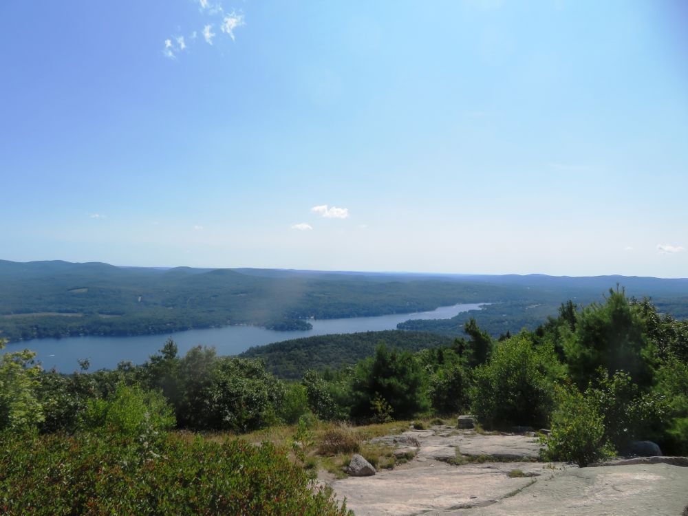
I arrived at the summit expecting to see a massive crowd of hikers but it was not bad at all. I was able to pick out a spot for myself and enjoyed the incredible views of Lake Winnipesauke. There was a good view of the Belknap Range to the west. It was a good day for lingering and basking and that's just what I did.
As I was wandering around the summit looking for the trail for my descent a hiker approached me stating that I looked like I had been here before. She wanted to know where the Yellow Trail was located. I first had to tell her this was my first time hiking this summit. I then asked do you mean the Brook Trail and she wasn't familiar with the trail names just the color of the trail. With me being color-blind I really wasn't paying attention to trail colors and also my first time here so I really wasn't able to help her.
I then walked over to the other side of the summit and sat down to enjoy the views from this direction. A man with his family approached me and said, "Sir, could you tell me where the Yellow Trail is?" I'm thinking "what"...again?! Apparently I present a seasoned hiker appearance.
It was time for me to start my descent so I started down the trail...it was the wrong trail and not the one that I wanted to be on, so much for the "seasoned" hiker. I went back to the summit reviewed my Gaia app and found the Mount Major Main Trail or Blue Trail.
There was some significant ledge scrambling from the summit that added a nice variety of terrain for today's hike. A lot of people were coming up this trail. I was glad to be going down since it was getting quite warm. The remainder of the hike to the parking lot was uneventful.
This was a very enjoyable and fun hike with spectacular views. There are 12 peaks in the Belknap Range that one can hike to qualify for a patch. I recently purchased a camp in the Lakes Region and it is now a relatively short drive to get to these peaks. This will be my next goal after completing the grid next year.

Serious erosion on this section of trail

No doubt where the trail goes here

Side trail

First view of Lake Winnipesauke

Summit up ahead

Lake Winnipesauke to the north

Lake Winnipesauke to the east

The M/S Mount Washington plying the waters of Lake Winnipesauke
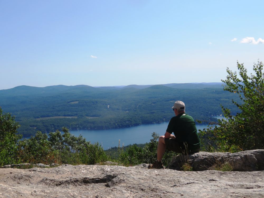
Enjoying the view
Alton Bay

Summit marker

Ledge scramble on descent

A look back at the summit

View from the trail

Last view on the way down

Map of the hiking trails on the parking lot kiosk
Having Fun in the Great Outdoors!
No comments:
Post a Comment