Summit: Mount Carrigain (4,700')
Trail route: Sawyer River Road, Signal Ridge Trail
Trail conditions: Road is clear, trail starts bare with intermittent icy sections then solid hard packed snow and a couple inches of fresh snow and drifting at higher elevations
Weather: Cool temps to start then warming up, sunshine and blue sky
Total miles: 13.4
Total time: 7:17
The weather forecast was looking ideal for a Spring hike today. I decided to do the long hike to Mount Carrigain with its extra miles this time of year due to the gate being closed on Sawyer River Road adding two miles each way. I did this hike at the end of March and it would be interesting to see the difference in trail conditions.
This would be a solo hike today and I was the first one in the parking lot early this morning. The road walk was dry, last month there was sections of ice that required traction to walk it safely. The first couple miles of trail was mostly bare with a few intermittent areas of frozen snow and ice that I could bypass without any problem. I took the old trail to the water crossings. The first crossing I rock hopped on submerged rocks so the boots got a little wet. The next two crossings were not a problem.
When I started the long relentless ascent to Signal Ridge the trail was completely covered in hard packed frozen snow and ice. I put microspikes on and had no problem until I got up to the higher elevations where there was a couple inches of fresh snow and drifting. The soft snow was balling up on my microspikes rendering them useless so I put on my trail crampons. This gave me good traction and there was no snow balling up on the spikes.
There was spectacular views from Signal Ridge and I could see the next problem that I would be dealing with. Fresh snow was hanging heavy on the trees up to the summit. With a warm wind blowing I knew there would be dripping water and snow clumps raining down on me. It wasn't too bad on the rest of the way to the summit. I took off my crampons and climbed to the top of the observation tower, I had the summit to myself. Under a clear blue sky the views were incredible. Back down below the tower I had a snack under the watchful eye of a gray jay. I put on a waterproof layer and started my descent.
I was expecting to see hikers coming up on my way down. Just below Signal Ridge I saw a familiar hiker coming up, it was Capt Chris. I have met him numerous times on the trail on previous hikes. We talked for a few minutes, got a selfie of us and then continued on. I saw several more hikers as I descended. The traction came off at the end of the frozen monorail and it was a nice hike back out to the trailhead. Two more miles of road walk and the hike was done. It was typical Spring conditions today.
This was my 11th time to Mount Carrigain, I need it one more time in February to grid it out. Grid count is now 534/576.
Enjoy the photos and videos!
Two mile road walk to the trailhead
Arriving at the trailhead
Remaining monorail
Dry trail
Old beaver pond
Easy water crossing
Very nice through here
Continuous snow packed trail starts here and the microspikes go on
Passing by an ice bulge
Fresh snow on the trail
Mount Washington
Vose Spur
Mount Lowell
Summit up ahead
Summit observation tower
Snow-capped Presidential summits
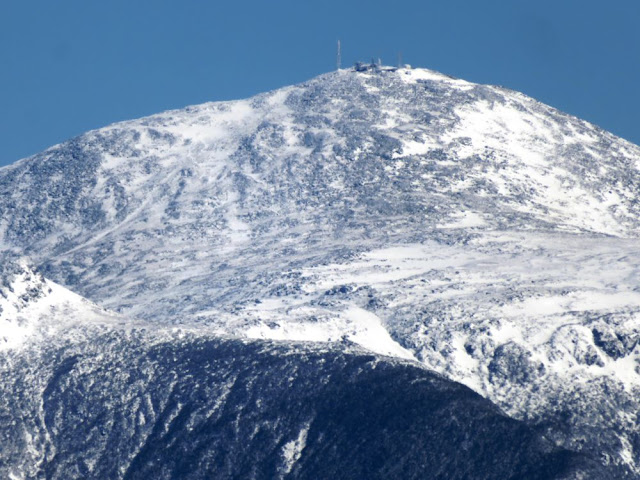
Mount Washington summit cone
Back into Winter
Snowy white trees against blue sky
Signal Ridge
A view all the way down the mountain
A view to the southwest
A view to the west
Mount Lafayette
My 11th time to this summit
Starting my descent
Heading across Signal Ridge
Two ski areas can be seen with Attitash in front of Cranmore
The Sisters and Chocorua
Met Capt Chris on the way down as he was coming up
Walked on submerged rocks at this water crossing
Back down to Spring
A final test of crossing an ice flow without falling and I passed
Whiteface Brook
Back at the trailhead
Compton tortoiseshell butterfly
End of the road walk is in sight and the end of the hike
Having Fun in the Great Outdoors!


No comments:
Post a Comment