Summit: Mount Isolation
Trail route: Rocky Branch Trail, Isolation Trail, Davis Path, Iso Express
Trail conditions: Dry trail to start then packed frozen snow, some wet sections and mud
Weather: Cool to warm with sunshine and blue sky, breezy on the summit
Total miles: 10.4
Total time: 6:40
After watching weather forecasts and trail conditions I decided to do the long hike into Mount Isolation. Thanks to the Teal Goat and Beefman for their trail report and detailed info on the latest trail conditions. This would be my 12th time to Mount Isolation doing it in every month of the year.
I was the first vehicle at the Rocky Branch trailhead parking lot. The trail was dry to start then soon got into icy sections that were easy to avoid. At the ski trail junction I put on microspikes. Further up the trail there was a few areas of water that were easy to get around.
As I started up the Engine Hill bushwhack I had to tread lightly through some muddy areas. The bushwhack seemed to go higher than usual but it was a solid frozen trail and I did not veer off of it. Once on the Isolation Trail it was a very short walk, maybe 50 feet, to the Iso Express bushwhack. The water crossing was an easy rock hop. The path was well tracked and solid up to the Davis Path.
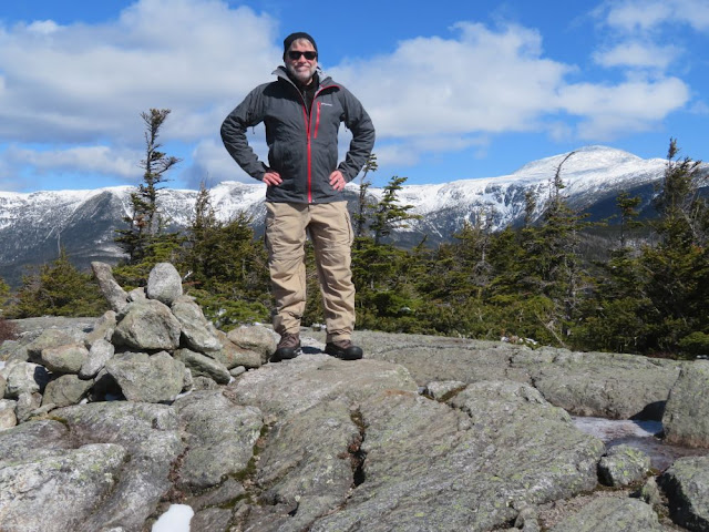
The steep spur path to the summit had a nice solid covering of snow making it an easy ascent. I added a layer just before popping out onto the exposed summit since there was a cool breeze blowing. I had the summit to myself and enjoyed the spectacular views. I spent a few moments reflecting on my 12 hikes to this remote spot. With a chilly wind whipping across the bare ledges I soon began my return hike to the trailhead.
Just before descending I swapped my microspikes for trail crampons just to have a little more grip in the softening snow and to prevent the snow from balling up on my traction. I met five friendly hikers on the way back. It was a nice hike out to the parking lot.
Other than a cool breeze on the summit the conditions, both weather and trail, were better than I expected. It was the best conditions that I have ever encountered on this hike. This can be a very long difficult hike at times depending on what time of year it is and I was glad to grid out this summit today. I have some tough hikes ahead of me this month and I was glad to get this one done. Grid count is now 530/576!
Enjoy the photos and video!
Dry trail to start
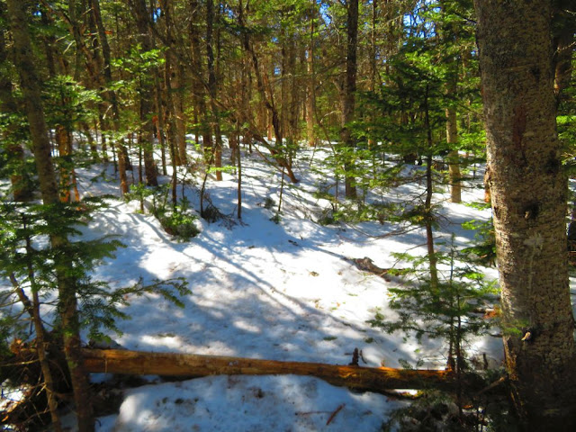
Frozen snow pack starts
Put the microspikes on here
There was a variety of trail conditions
Wet and muddy ahead
Trail firms up
Wet but avoidable
Passing into the wilderness
"T" marks the Engine Hill bushwhack
Crossing the log into the bushwhack
Passing through one of many birch glades
Sun shines through birch trees
Birch glades continue
More birch glades
Water crossing to Iso Express
Low water makes an easy rock hop
Spur trail to the summit
Almost on the summit
View from the summit
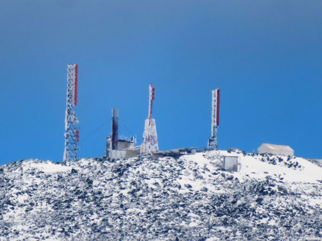
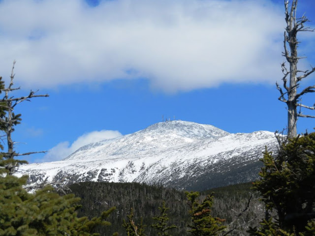
Mount Washington
Mount Washington cone
Mount Washington summit
Mount Monroe
Mount Eisenhower
On the summit of Mount Isolation for #12
Descending and starting the hike back to the trailhead
One last view of Washington from the trail
Stick stuck in the snow marks the Engine Hill bushwhack
Back through the birch glades
Leaving the bushwhack and onto the Rocky Branch Trail
Open water on the trail
Monorail fades away
Dry trail
Back at the trailhead
Having Fun in the Great Outdoors!


Don thanks for the blogging in general. I always enjoy your posts and have learned from your hikes. You have hiked so many peaks. I have done a lot, but I have a long way to go compared to you. Awesome hike! That hike should have been 14.2 if you didn't bushwhack. I saw the mark on the tree and if there are existing footprints I guess you wouldn't get lost. Seems like it is a frequently used trail in the winter with the footprints? It is not on the map and I have not hiked that summit or area yet and will need to at some point to complete the 48. Are there any markings or signs other than the T in the tree? How is the in the summer when the snow is gone? Is that shortcut trail used in the summer also and can you discern the trail from the woods? Thanks for the pictures and the info. Tom
ReplyDeleteTom,
DeleteThanks for checking out the blog. One of the reasons I blog is to provide information for others that may be interested in hiking the same trails that I do.
The Engine Hill bushwhack and Iso Express bushwhack are nice shortcuts in the winter. Your mileage is correct if not doing the bushwhacks. I use the Gaia GPS app on my phone and it actually has the bushwhacks for this hike. The T is the only marking at the beginning of the bushwhack. Shortly after starting this bushwhack there is a bog that barely freezes up during the winter and I have seen someone sink to their thigh when not frozen as well as read a trail report from someone that sunk to their waist, dangerous if hiking alone. So this route is not used in the summer. I have been with a group that broke trail through here, it can be tough especially without GPS. This past winter the trail was broke out high but it was frozen solid so I did not wander off it. Iso Express would be very tough to navigate if it has not been broke out and you do not have GPS. I would recommend only using the bushwhacks after being well frozen, a good snowfall and GPS if it has not been broke out.
There are 5 water crossings on Isolation Trail, if the water is high it will be impassable and the trail can just be generally wet. I did have a failed attempt once in the month of May, it was a very tough hike on crumbling monorail with running water beneath. The river was high making it a dangerous water crossing. I turned back at the river. It seems like I've seen more Iso failed attempts than any other hike.
Having pointed out all the negative aspects of this hike it can be a very nice hike although long. Most of my hikes to Isolation have been good, there are no long steep climbs although the last couple hundred feet to the summit ledges is steep but not a problem. I have also done this hike several times via Glen Boulder Trail with spectacular views, lots of climbing but avoids the water crossings.
Hope this helps, have fun hiking this remote summit!