Summit: Carter Dome (4,832')
Trail route: Nineteen Mile Brook Trail, Wildcat Ridge Trail (attempt), Carter-Moriah Trail, Carter Dome Trail
Trail conditions: Solid trail down low, loose and crusty snow higher up
Weather: Cool/mild temps, overcast sky
Total miles: 9.8
Total time: 7:46
The plan for the last day of February was to hike Wildcat A. The weather was looking favorable but I was unsure about the trail conditions. I had not seen any recent trail reports for Wildcat Ridge Trail but was hoping someone had broke it out within the past couple of days.
I arrived at the parking lot to find several vehicles ahead of me so I was hopeful someone else was also going to Wildcat A today. I started my hike with microspikes on a well packed trail. It was an easy hike up to the Carter Dome Trail junction. I continued to be hopeful as I saw the trail was broke out past the junction but it was short-lived. Another 100 feet and there was only one set of snowshoe prints.
I swapped my microspikes for snowshoes at this point as there was a crusty layer of snow over the solid base. Further up the trail I met the hiker who was making tracks. He was stuck almost waist deep in snow after crossing over a blowdown and his snowshoe got stuck in the deep snow. He finally dug himself out and told me he was going to Carter Dome. That made me less hopeful that the trail to Wildcat A would be broke out.
So we hiked together up to the trail junction. There were two hikers coming down the trail that had hiked Carter Dome and they gave me the news that the Wildcat Ridge Trail was not broke out. When we reached the junction I saw the unbroke trail going to Wildcat A and new I had my work cut out for me. The other hiker kept going to Carter Dome.
I started up to Wildcat A and it wasn't long before the going got tough. New snow was a few inches deep to knee deep drifts. As it got steeper the loose snow would slide down under the hard crust beneath. Just before the slide I decided to turn around, I was exhausted and only three tenths into the seven tenths of a mile that I needed to ascend to the summit. At this point I was sliding down the steep slope into the trees. Crossing the slide was way beyond my confort zone as a slip or slide there would send me a couple of hundred feet down the mountain.
As I made my way back down to the junction I met two younger hikers coming up and let them know I had turned around at the slide and they would be breaking trail from there. When I reached the junction I decided to ascend Carter Dome. I needed this summit for February and thought it was a good way to salvage this hike. I've been down that trail but never up and I knew this would be a tough hike.
I dropped down to Carter Lake and started my hike to the summit on the Carter-Moriah Trail. It did not take long before it started to get very steep but at least it was broke out. The hiker that I had met earlier was just ahead of me and it wasn't long before I caught up to him. We hiked together for a short distance then I passed him. There was a lot of loose snow and there were some sections that were easier on hands and knees to get up through the very steep areas.
It was nice to get past the steep section although it was still a gradual climb to the summit. There was a lot of snow up there. I stopped briefly at the summit and started my descent, it was all downhill from here and the difficult part of today's hike was behind me. I bypassed Mount Hight and kept going down to Zeta Pass.
At Zeta Pass I kept going without stopping. The couple of water crossings were well snowbridged and it was an easy hike back down to 19 Mile Brook Trail completing the loop. The temperature had warmed up above freezing. I swapped my snowshoes for my trail crampons that has a feature that prevents the snow from balling up on them. It was a good hike back down to the trailhead.
The hike did not go as planned today but I did manage to climb another summit that I needed for February. It was a very tough day of hiking!
Enjoy the photos!
Mount Washington from the Peabody River on the way to the trailhead
The hike starts here
Coming up to the bridge crossing
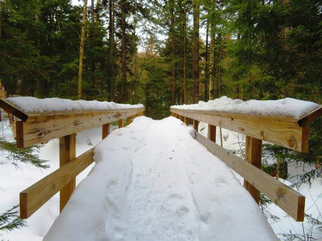
Deep snow on the bridge
19 Mile Brook
Only one set of snowshoe prints beyond the trail junction
Wildcat Ridge Trail junction
Wildcat Ridge Trail was not broke out
Down at Carter Lake after my Wildcat A attempt
Taking in the view and catching my breath at the top of the steep section
Carter Notch Hut down below
Wildcat A
Adams and Madison
Getting closer to the summit
Summit is just ahead
Mount Washington
Icicle tree
Gray jay looking for a handout
Walking on top of deep snow as I start my descent
Mount Hight
Northern Presidential summits
Zooming in to Mount Washington
Hikers can be seen on Mount Adams
View from the ridgeline
Trail to Mount Hight
At Zeta Pass
Solid snow bridge on water crossing
Log crossing was not broke out
Easy under blowdown but watch your head on protruding branches
Another snowbridged water crossing
Back at 19MBT to complete the loop
Dam photo
Back at the trailhead
Having Fun in the Great Outdoors!


No comments:
Post a Comment