Summits: Mount Carrigain (4,700')
Trail route: Signal Ridge Trail, Carrigain Notch Trail, Desolation Trail
Trail conditions: Dry and damp trails with wet and muddy sections
Weather: Cloud cover with cool and mild temps
Total miles: 13.8
Total time: 8:30
There was blue sky, sunshine and tolerable Fall temps in the weather forecast. I've learned not to put a lot of faith in the weather forecast for good reason, this is New England and the weather is always changing regardless of what the forecast may be. I would be joining Jill and Larry for a hike to Mount Carrigain. We would be doing a loop hike using the Desolation Trail, a trail that none of us had done before.
We met at the Signal Ridge Trail parking area and started our hike just after 7:30. After a clear sky on the drive to the trailhead and some early sun the clouds started to move in, that was not in the forecast. The temps were cool and it was a refreshing hike along the lower section of the Signal Ridge Trail. We then turned onto the Carrigain Notch Trail. It was along here that we met three hikers, one of them Ben doing Mount Carrigain for his final 48 4,000 footer.
We continued on and after 6.6 miles we reached the Desolation Trail. The description of this trail is rather ominous. I think we were all quietly, mentally preparing ourselves for the climb up. It's a 1.9 mile climb to the summit. I would have to say it is exactly as described. It is an initial gradual climb then comes to a very steep and rocky section. Some places requiring handholds to get up over the large rocks. It then gets better further up before eventually reaching the summit. Met many hikers coming down as we went up.
Up on the summit there were many hikers as expected. We went straight up to the top of the tower but there was not the usual spectacular views. The weather forecasters got it wrong today. Clouds covered the summit and there were brief limited views revealing spectacular Fall foliage colors. There was a cool breeze blowing and after a few photos we dropped down to the bottom of the tower for some lunch. The clouds never departed and after a break we started our 5.3 mile descent back to the trailhead.
Down from the summit and across Signal Ridge the clouds hung tight. As we descended there were many hikers still coming up. It was an enjoyable hike down but also tiresome. We reached the Carrigain Notch Trail junction and completed the loop. There was still two more miles of hiking on the Signal Ridge Trail to get back to the parking lot.
Just as we returned to the trailhead parking lot a light rain started. That's what I call good timing. We completed 13.8 miles in 8.5 hours. Even though the weather was not ideal with the summit clouds and no views it was still a very enjoyable hike. The Desolation Trail lives up to its name as it is in a very desolate location. Always nice to experience a new trail that we haven't done before. It was a fun and adventurous hike with Jill and Larry!
Crescent moon above Wildcat on the drive to the trailhead
Whiteface Brook
Water crossing
Reflection
Turning onto the Carrigain Notch Trail
Log full of mushrooms
Dry stream crossing
Into the wilderness
Log crossing
Sunshine before the clouds move in
The leaves brightened the way
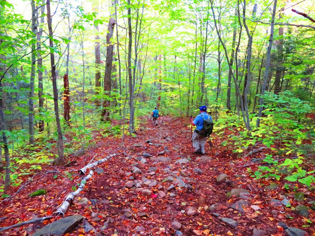
A beautiful walk through the woods
Lots of color on the ground
Cleared blowdowns
Water crossing at the start of the Desolation Trail
An area that sees a lot of stream erosion in high water
The first of many piles of moose poop on the Desolation Trail
Unexpected clouds that were not in the forecast
There is old telephone wire along the trail providing a trip hazard
There are occasional views along the trail
A steep section of trail
A tricky set of rocks to get up and over
Another view
This gray jay was looking for a handout
Still being followed by the same gray jay
The summit is in sight
Jill coming up onto the summit from the Desolation Trail
Arriving at the summit
A view toward Vose Spur
Larry and Jill eating lunch below the tower
Starting our descent
Crossing Signal Ridge
Pausing on a cloudy Signal Ridge
A view from the trail
Going down Signal Ridge Trail
Hobblebush leaves
Hiking the final 2 miles after hiking 11.8 miles
Puffballs
Final water crossing of the day
The hike ends here after 13.8 miles in 8.5 hours
Having Fun in the Great Outdoors!


Looks like a great day 😇
ReplyDeleteYou really need to join us sometime, Jon!
DeleteDefinitely an interesting and fun hike, Jon!
DeleteAwesome day, Don!
ReplyDeleteAn enjoyable hike Jill, on a trail less traveled to a familiar summit.
Delete