Today would be a solo hike to one summit, Mount Isolation (4,003'), a round trip of 12 miles. My route would take me up the Glen Boulder Trail then down the Davis Path to a spur path up to the summit of Mount Isolation then returning on the same trails. Partly cloudy, cool temps and a possibility of late afternoon showers were in the forecast.
I arrived at the trailead before sunrise. There was just enough light that I did not need the headlamp. It quickly brightened as I moved up the trail. At this point I'm not sure if I was half asleep or not paying attention but I soon found myself on a trail that did not look right. There was a lot of tall grass growing up in the trail and I looked up to see blue diamonds marking the cross country ski trail. I hadn't gone far so it was a short walk back to the Glen Boulder Trail and I was on my way up again.
When I reached the exposed section of the trail it was cool, windy and cloudy. I could barely make out Glen Boulder up ahead. When I got up to the big boulder the clouds were quickly moving out and it was quite a scene watching them blow down through Pinkham Notch. Above me the moon was still showing in a clearing sky. I stopped briefly to capture some photos then continued on up.
The wind was blowing and it was very cool. The trail enters a scrub area and I was out of the wind. I consider this area of the Glen Boulder Trail as an oasis from the elements. There was no wind here and the sun was shining down through the trees. I was soon back in the wind as I came out onto the exposed trail again. I reached the Davis Path junction and started my descent to Mount Isolation.
Mount Monroe was the only Presidential summit that was not in the clouds but that would soon change. There was just a slight breeze along this exposed section of trail and I was soon dropping down into the trees again. There was some water and mud along part of this trail but nothing too bad. The old and rotting bog bridges helped to keep the feet dry.
I met the first hikers I had seen today that had just come from Mount Isolation. I arrived at the summit and had the place to myself, except for the arrival of two gray jays that were looking for a handout. The Presidential summits were now completely cloud covered. I took some photos and had something to eat before starting the trip back. It would be three miles up the Davis Path and three miles down the Glen Boulder Trail.
I kept remembering my first hike to Mount Isolation taking the same route. It was during my start back up the Davis Path that I developed severe almost debilitating muscle cramps in my legs. Slowing my pace and more fluids got me back up the trail. Today was much cooler but I still had the same concern. I met many hikers on their way to Isolation.
I reached the Glen Boulder Trail junction and this time without any muscle cramps. It would be all downhill from here. While clouds continued to linger over the Presidential summits Pinkham Notch was now clear. There was a momentary clearing on Mount Washington and I was able to see the summit but it soon clouded over and that would be the only time I would see the summit today.
It was a relentless rock hop down the Glen Boulder Trail and my legs were getting tired. I passed by Glen Boulder without stopping. Dropping down into the woods I sat down for the first time today and took about a five minute break before continuing my descent. After 8.5 hours and 12 miles I was back at the Glen Ellis Parking area. It was three miles up and three miles down then returning three miles up and three miles down.
My preferred route for this hike is to go up Glen Boulder then out Rocky Branch Trail but that requires a car spot. I could have gone out and back via Rocky Branch Trail but would have missed the incredible views. This was a very enjoyable hike and the clouds added to the magnificent views. I still need to do this hike during the winter which is done via the Engine Hill bushwhack that shortens the hike by a couple of miles. I plan on adding Mount Isolation to my list of hikes for this winter!
Enjoy the photos and videos!
Started my hike just before daybreak
Trail is starting to brighten up
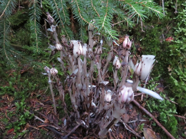
Indian pipe still standing
Ledge scrambling starts
Looking back down into the clouds
Glen Boulder through thin clouds
Glen Boulder
Moon up above
Clouds are on the move
Clouds roll through Pinkham Notch
Mount Monroe
Zooming in on the summit of Mount Monroe
On the summit of Mount Isolation
Gray jays made an appearance
Mount Washington in the clouds
View from the summit of Mount Isolation
Mount Kearsarge
Going back up there
Davis Path passes under this fallen tree full of Grandfather's beard
Reindeer lichen
Looking up the Davis Path
Looking down the Davis Path
On the Glen Boulder Trail
The summit of Wildcat
Wildcat ski area
Pinkham Notch has cleared up
A momentary view of the Mount Washington summit
Above Glen Boulder
Glen Boulder below
Here's where I turned onto the ski trail on the way up
Back at the trailhead after 8.5 hours and 12 miles
Having Fun in the Great Outdoors!


No comments:
Post a Comment