The day began with a deep blue cloudless sky. It was a beautiful ride through Pinkham Notch as I drove to the trailhead, a complete turnaround from last Saturday when it was foggy, cold and wet. Today's hike would take me to the top of Mount Tremont using the Mount Tremont Trail. The trailhead is on Route 302 and it took me two drivebys to find it. There is a small pulloff across the road from the trail and when I arrived there was one vehicle parked here that drove off as I was getting ready for the hike.
Trailhead
At the last moment I strapped my snowshoes on the pack - just in case! After reading many trail reports I was not sure what I would be running into. One report had hikers turning back before reaching the summit just two weeks ago. My own experience from two weeks ago was fresh on my mind when I had to posthole my way back from a hike. This would not be a long hike (2.8 miles to the summit) so I decided to carry the extra weight.
Garter snake - that I almost stepped on!
Mount Washington
Rare patch of ice on the trail
A duck-under
The first part of the trail follows Stony Brook and there are many waterfalls and cascades along the way. There was a good flow of water coming down the brook and I found myself dropping down off the main trail to take many photos.
View from the summit
Geological marker
...another marker
...and another marker
This is a well-marked trail with relatively fresh blazes. Blowdowns along this trail are numerous but were easy to cross, go around or under. Carrying the snowshoes ensured that the trail was clear from snow with just a few inconsequential patches of ice. My face made sure that all the spider webs were removed for all other hikers that would use this trail today. I found no problem areas on this trail and it was a nice climb to the summit.
Southwest view from the summit
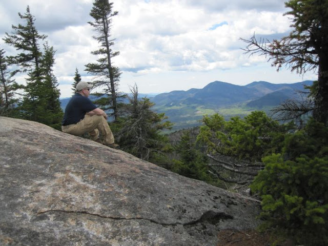
Enjoying the view
Upon reaching the top of Mount Tremont a 180 degree view opens up to the south. Down below is a nice view of Sawyer Pond and Little Sawyer Pond. It was a solitary ascent and I had the summit to myself. There were no other hikers on the way up.
Mount Chocorua
Sawyer Pond and Little Sawyer Pond
Looking around I found three geological markers, not sure why. I stayed at the top long enough for a snack and some photos. Clouds were starting to form and it looked like a possible shower may be looming but the descent was dry.
Big tree on a big rock
On the way down I met my first pair of hikers. A little bit further I met four more, make that five, there was an infant in a backpack. There were four more hikers after this and that was all I saw for the day. Unlike the scene I saw in Pinkham Notch on the way home, the parking lots were full and vehicles lined up along Route 16. I avoided the crowd today.
When I reached the bottom portion of the trail along Stony Brook there were waterfalls that I had missed on the way up. So once again I found myself rock hopping along the brook and getting some nice photo shots.
I found the hike to Mount Tremont very enjoyable with fantastic views of the southern White Mountains!
Having Fun in the Great Outdoors!


Don, this is one of the best reports I've ever read about a hike to Mt. Tremont. You did a super job of capturing the beauty of the trail along the way, as well as the beauty at the summit. So many reports tend to focus mainly on the 'views from the top'.
ReplyDeleteYour report was also very informative to me as the volunteer maintainer for the Mt. Tremont Trail. A few weeks ago, I did some maintenance on the lower end of the trail, but deep snow prevented me from working on the upper/steeper end of the trail. Thanks to your report, I now know that the snow has melted. And so, I'll be going up there soon to take care of at least some of the downed trees that you mentioned.
Did some of the downed trees appear to be recent blowdowns? I know there are several old ones which are too large for me to handle, and so I've left them for a Forest Service crew to handle whenever they have the manpower to get to them.
Thanks for posting this report . . . much appreciated!
John
Thank-you John,
DeleteI actually read your blog trail reports prior to going on this hike. The snow you mentioned made me over-cautious, thus the reason for carrying the snowshoes. That seems to have ensured there would be no snow or ice on the trail and they got a free ride. I lost count of the blowdowns but some did appear to be fairly recent. A bow saw should handle the job on some of them.
You chose a beautiful trail to maintain. I appreciate the work you do to maintain this trail!
~Don