

Summits: Mount Pierce (4,310')
Trail route: Crawford Path, Webster Cliff Trail
Trail conditions: Very wet trails with slippery roots and slick rocks
Weather: Low cloud cover and mild temps
Total miles: 6.4
Total time: 3:46
After going to work this morning I took some time off and headed to the Mt. Clinton Road parking area for a hike up to Mount Pierce. I've hiked this mountain many times but today would complete my goal of hiking this summit in every month of the year. The drive to the trailhead was gray and dismal but the forecast was calling for slowly diminishing clouds, emphasis on slowly as I would find out throughout the hike.
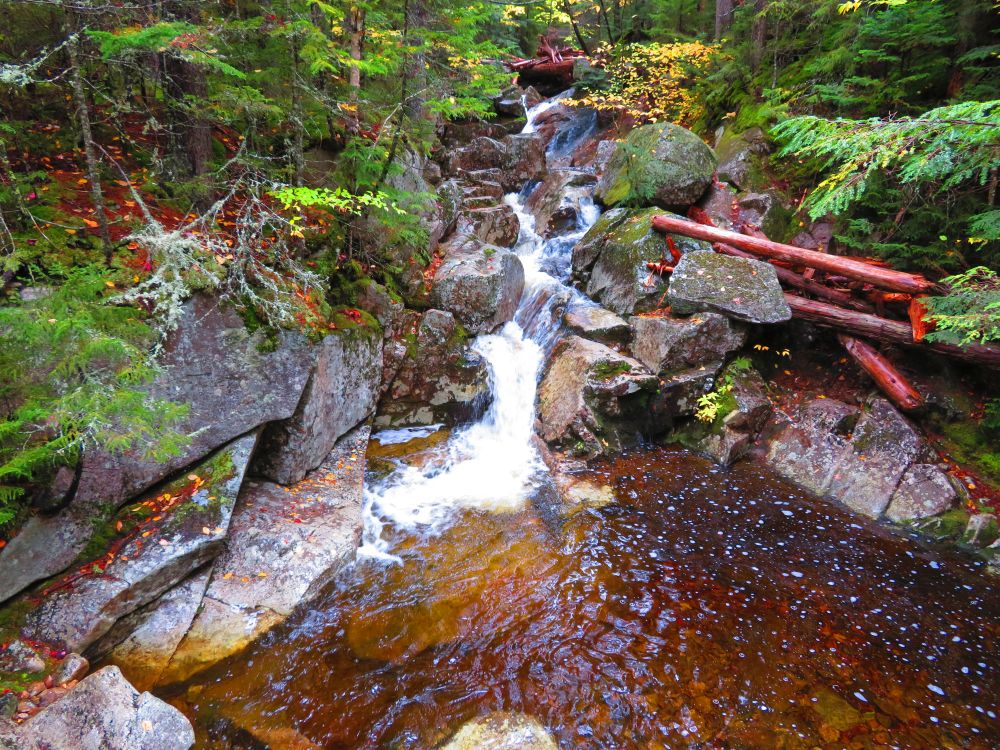
There were several vehicles in the parking lot so there were other hikers on the trail. I was soon on my way. The trail was very wet from last night's rain and it was only going to get wetter. I dropped down to Gibbs Falls for a quick pic. I continued up the trail, everything was soaked. The roots were slippery and rocks were slick. I slowed my pace to keep from slipping.
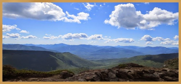
Past the Mizpah Cutoff junction the trail got very wet with water flowing down the trail. Further up there was sections of mud and standing water. I arrived at the Webster Cliff Trail junction and could see the sun trying to burn through the clouds but it never did. Views were non-existent today.
There was a couple coming down from the summit as I went up. When I reached the top I had the summit to myself, a rare treat as this is a popular mountain for hikers. But today there were none of the spectacular views of the Presidential summits that can be seen from here on a clear day. A few pics and I began my descent. It was the same wet trail on the way down. I carefully watched my step as I was going down because I usually have a tendency to slip and fall when I'm descending in these conditions.
I reached the parking lot without falling. There was the same low cloud cover as when I started but the Fall foliage was looking spectacular below it. With the completion of this hike I successfully gridded out Mount Pierce having now hiked this summit in every month of the year. I have hiked to this summit in a variety of conditions including snow, cold, ice, rain, heat and have enjoyed every hike. I now have 46 more summits to grid out!
Enjoy the photos and videos!


The hike ends here back at the beginning
Having Fun in the Great Outdoors!
Just came across your blogS in my emails. Enjoying the reading of your hikes. I'll have more time to read more when we settled into our winter quaters in Tucson. Thanks for sharing
ReplyDelete