


Summits: Mount Garfield (4,500')
Trail route: Gale River Loop Road, Garfield Trail, Garfield Ridge Trail
Trail conditions: Hard packed and soft packed trail with an unbroken section to the summit
Weather: High, thin cloud cover and cold temps
Total miles: 12.4 RT
Total time: 6:25
With only one more month of winter I need to get four more hikes to complete the Winter 48 4,000 footers. This can be tough when factoring in weather, trail conditions, work, and a couple of very long hikes remaining on my list. Today's weather was looking good for a weekday hike so I took the day off from work and decided to hike Mount Garfield, one of my remaining Winter 48 hikes.
The weather forecast called for cold temps and clouds moving in ahead of a winter storm arriving tonight. In the winter the road is not plowed to the trailhead and it is a 1.2 mile road walk to get there. It's then a 5 mile hike to the summit making this a 12.4 mile hike in the winter. This is usually a very popular hike with its easy gradual rise in elevation and spectacular views at the summit. It would not be so popular today.
I drove into the plowed parking area and was the first one there. I layered up in the dark. By the time I was ready to go it was light enough that I didn't need the headlamp. It was a very cold road walk to the trailhead. My car thermometer had a reading of -8°F and even though there was no wind it was still very cold. I did the 1.2 mile road walk in about 20 minutes and turned onto the Garfield Trail without stopping.
I was three miles into the hike before I saw the sun rise up above the mountains. Up till now I was bare booting without any problem. The trail was hard packed with just a light coating of powdery snow. There were ski tracks on the trail from probably the day before. The powder was getting a little deeper and the snow a little looser so I put on my microspikes. The snow was hanging heavier in the trees as I got higher up the trail.
I reached the Garfield Ridge Trail and continued up to the summit. I followed the packed trail and soon noticed that it was not following the regular trail. The Garfield Ridge Trail was not broken out to the summit and I had missed it by following this packed bushwhack. I have been up here many times and knew I was not going in the normal direction but I kept going at this point. I picked my way along and eventually could see the summit. I came up around to the left of where the trail normally comes out.
I went up onto the summit and went inside the concrete foundation from the old fire tower. There was a bit of a breeze blowing and the temp was 6°F, it felt very cold. The sun was shining through high clouds and there was a noticeable ring around it indicating an approaching storm. I took some photos and a video. That was more than enough time on the summit. My fingers and toes needing warming up so I started my descent.
I decided to go down the unbroken Garfield Ridge Trail. This proved to be somewhat challenging. I was not sure if whether or not there was ice under the new snow so I started down. As I dug in with my microspikes slabs of snow would break away and I found myself riding down uncontrolled so it became necessary to start tree hugging. Once past the steep section I was able to easily maneuver myself down until I reached the broken out trail.
It was a pleasant hike back down. I was following my own set of footprints from when I came up. There had been no one else on the trail and I saw nobody on this entire hike which I considered to be highly unusual. Of course it was midweek, it was very cold and there is a road walk to get to the trailhead in the winter so those could have been contributing factors as to why no one was hiking here today besides me.
I now have three more winter hikes to complete the W48. These hikes include Lincoln/Lafayette (~8.8 miles), Owl's Head (~16.5 miles), and Zealand (~18.6 miles). Spring starts one month from today on March 25th at 5:58 P.M. EDT. All official winter hikes must be completed at that time. I'll be closely watching the weather and trail conditions over the coming weeks so I can hopefully get some optimal days to complete my remaining winter hikes.
Enjoy the photos and videos!

Ready to do the road walk to the trailhead

Crossing the first bridge on the road walk

Crossing the second bridge

Arriving at the trailhead

Heading up the Garfield Trail

Not much snow through here

Nice snow bridge over water crossing

Another easy water crossing

Sunrise

Sunshine on the trail

Ice formations in a brook

Tea time

A wet section of trail

Passing through a snowy portal to the forest beyond

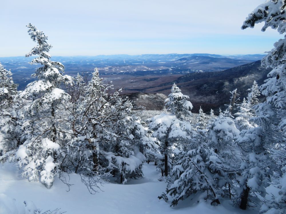
A view from the trail

Lots of snow here because without snow I'm looking up at this sign

Diminished sun through high clouds

The last 0.2 mile to the summit

The summit is up ahead

A view into the Pemigewasset Wilderness
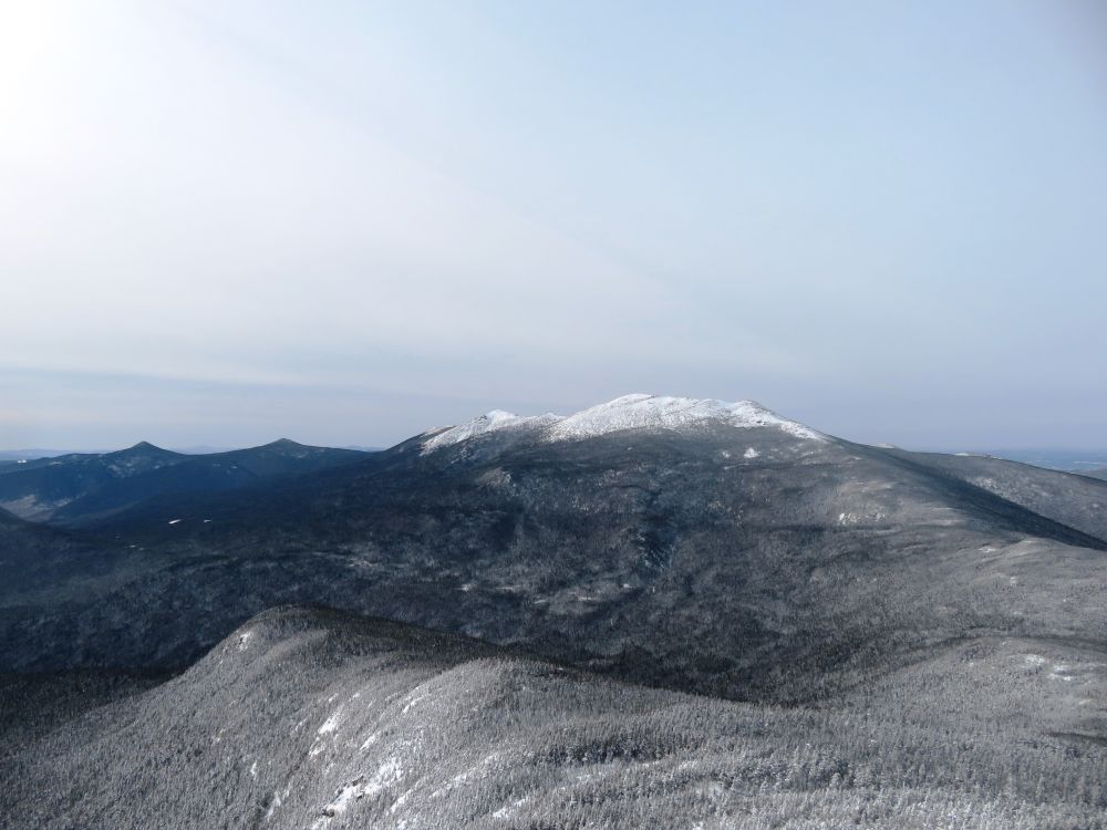
Franconia Ridge in the distance

Mount Flume

Zooming in on Mount Flume

Mount Liberty

Mount Lafayette
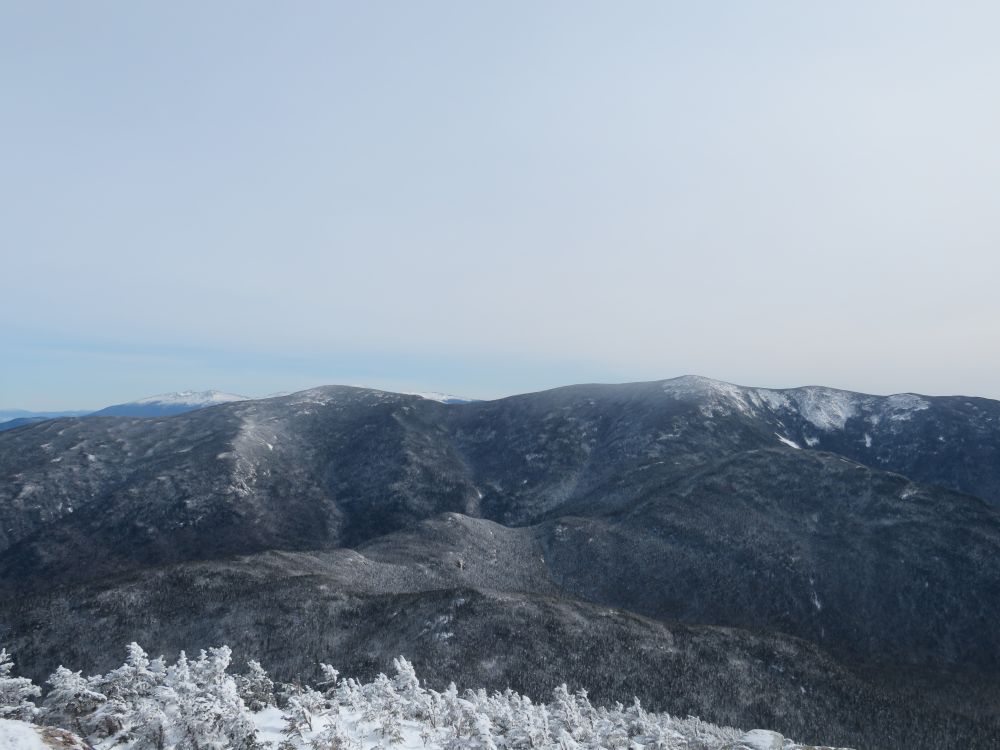
North Twin and South Twin

A view of Mount Washington through the col between the Twins

On the summit of Mount Garfield


Ring around the sun warning of the approaching storm
Ascending an unbroken trail

A look back up at the sun while descending

Snow-capped mushroom

Trailhead is in sight

Back at the trailhead

Back at the parking area after 12.4 miles
Having Fun in the Great Outdoors!
No comments:
Post a Comment