


After a week of mixed precipitation and rain the weekend weather forecast was looking great. I chose one of my favorite summits for today's hike, Mount Garfield (4,500'). This is a great hike with a moderate climb to the summit with spectacular 360° views. Today would include a couple of additional miles due to the road being closed to the trailhead.

Road still closed


At the trailhead


Water crossing

Rotten ice on the trail with water beneath

Another water crossing
The early morning sky was looking quite threatening with low clouds as I was packing to leave. As I drove to the trailhead it appeared the clouds were clearing but it was very slow and the summits remained covered. I arrived at the Gale River Loop Road to find three other vehicles in the parking area. The gate was closed as expected and it would be a 1.2 mile walk to the trailhead before beginning the 5 mile hike to the summit.

A bare trail

The ice starts

The microspikes go on

Trees are frosty


Very icy section of trail


Sun shines down through frosty forest
It was a cool start to the morning and the cloud cover was holding firm. The road walk provided a nice warm-up before reaching the trailhead. There was bare ground along the first 2 miles of the trail and then sections of ice that I could walk around. The water crossings were a little tricky but I found if I stepped on the rocks that were slightly submerged I could avoid the icy exposed ones and the feet stayed dry. When the trail ice became constant I put on my microspikes and they would stay on up to the summit and back down to the same spot where I put them on. The trees had a heavy coating of frosty ice as I made my way up through the cloud cover.

Beautiful through here


This sign is wrong, you are NOT here


Only a 0.2 mile hike to the summit from here


Unbroken trail
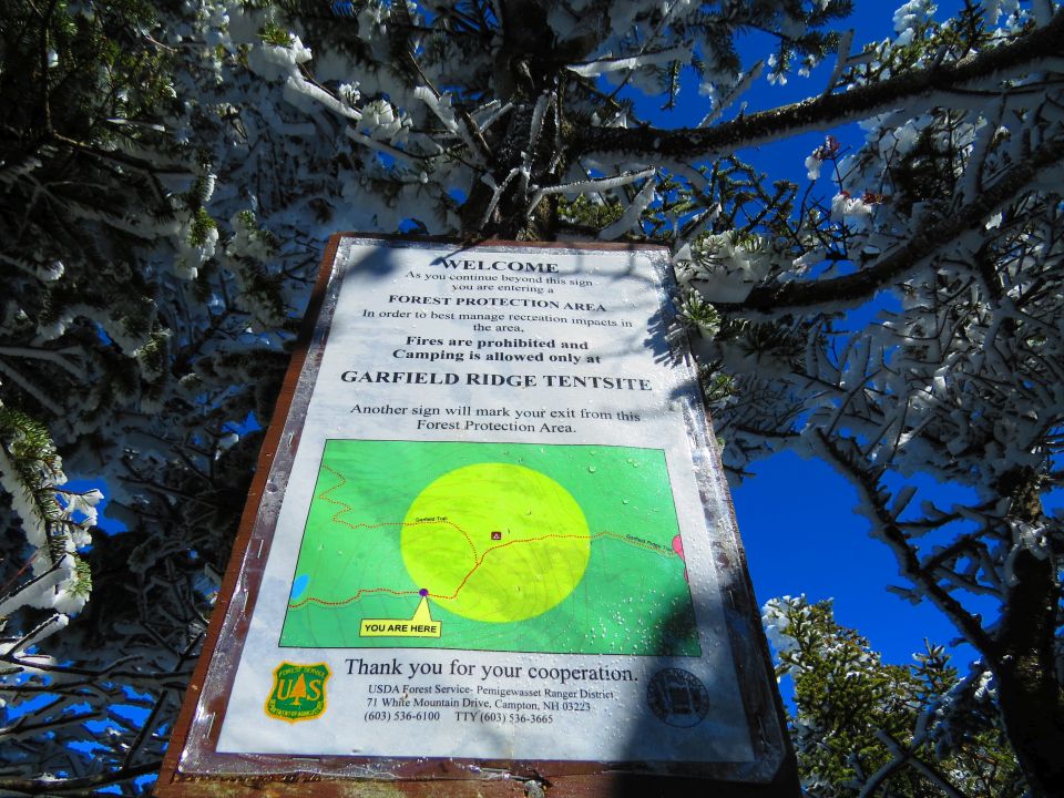
Just before the Garfield Ridge Trail junction there is a sign on a tree that indicates,"You Are Here". The sign is wrong and you are not actually where it is pointing to. The same sign was there last time I hiked this trail. When I reached the trail junction I noticed there were no tracks to the summit, mine would be the first. I thought sure there were other hikers ahead of me from the other cars in the parking area.


Another 100 yards to the summit

Ledges to the summit

Mount Lafayette

Awesome undercast


Looking into the Pemigewasset Wilderness

Mount Lafayette
The last 0.2 miles to the summit are steepest. There was a clear blue sky overhead and I got the first glimpse through the trees of an undercast down below. With each step closer to the summit the views just continued to open up until there were views in every direction. I had the summit to myself, for a moment. The views were mine and mine alone from this lofty perch. While there was a heavy undercast to the north the Pemigewasset Wilderness was protected by the surrounding mountains and completely cloud-free, it was an amazing sight!
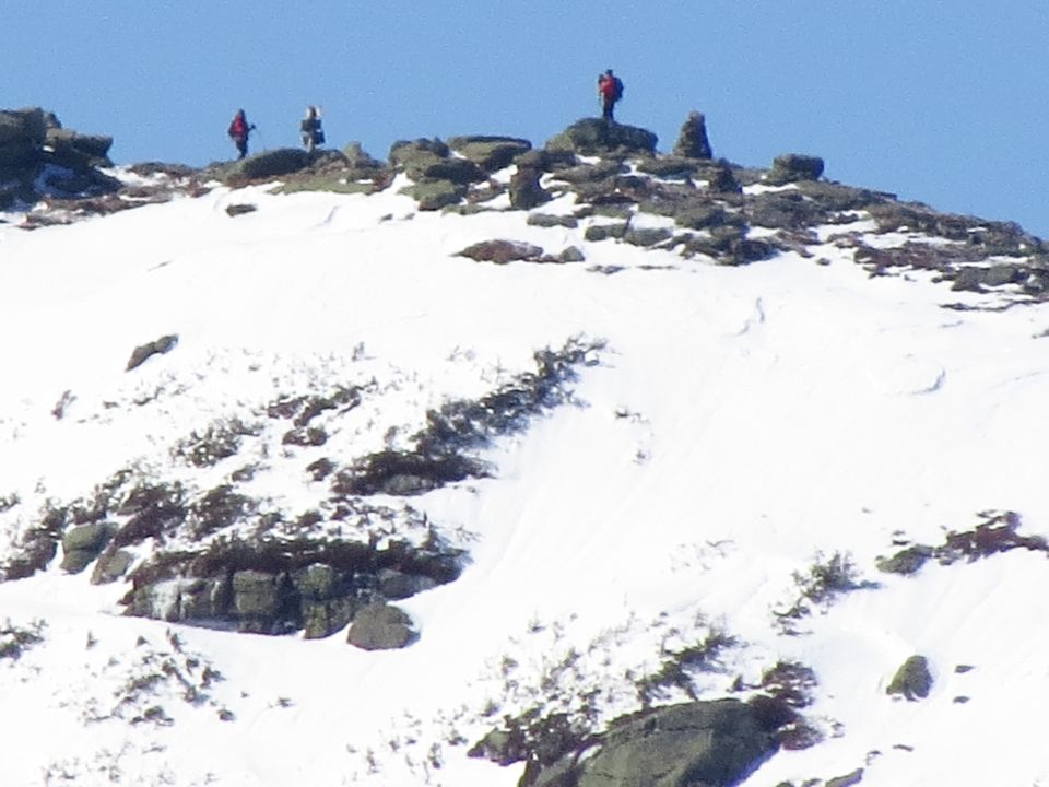
Hikers on the summit of Mount Lafayette


Mount Flume and Mount Liberty

Distant mountains appear as islands in the undercast

Presidential summits

Looking down into the undercast

Mount Washington
Within a couple of minutes two young ladies with a dog stepped up onto the summit. While we were taking photos I asked if one of them would take a photo of me with my camera and I took one of them with their camera. The funny part was their dog wanted to be in the photo with me and was very insistent. He jumped up on me and we got some great pictures together!


Friendly guy just wants his picture with me


Another shot with me and my new friend
I spent a lot of time taking many photos, just couldn't help myself. Between the clear, blue sky and the undercast it made for some dramatic views. Other hikers continued to arrive while I was on the summit. I had gotten my fair share of photos and it was time for me to start my descent, 6.2 miles back to the parking area.


Cannon Mountain

Cannon summit tramway terminal


There were many hikers coming up the trail as I made my way down. They were in for a real treat once they reached the summit and were able to absorb those views. The warmer afternoon temps softened the loose snow but it was a very easy descent even on the icy areas. The frost and snow were melting off the tree limbs and at times felt as though it was raining and snowing. I reached the end of the ice and removed my microspikes. It felt good to walk on the bare trail free of snow and ice although there were some muddy areas that were quite slick and slippery.

Lower peak poking through the clouds


Turkey tracks


Back at the trailhead I began the 1.2 mile walk to the parking area. I quickly found out why the White Mountain National Forest roads stay closed long after the snow is gone. While the the road was firm and frozen this morning after warming up it was now very soft and spongy to walk on. I actually found it to be annoying and walked along the side of the road where it was a little bit firmer. Vehicle traffic would wreak havoc on these forest roads and make them impassable in the muddy ruts they would create.


Reflecting pool


Back at the trailhead

1.2 mile road walk

No bear sightings today
I was glad with my choice of summit today but I'm going to assume that any hike would have been just as good given the overall conditions. It was a fantastic day in the White Mountains for my first Spring hike this year!
Having Fun in the Great Outdoors!
No comments:
Post a Comment