After watching the weather all week and planning for a hike to Mount Isolation the decision was made last night to postpone that hike and wait for a better day. The forecast called for cloudy skies and partly sunny with afternoon showers. I would be joining fellow hikers Brian and Jill today. Brian needs to hike Mount Isolation to complete his 48 4,000 footers. We'll watch the weather for next weekend. The alternative plan for today was a hike to Mount Tremont (3371') via the Mount Tremont Trail then down the other side on the Brunel Trail to Owl's Cliff (2940') and return on the same trails.
Sun rising over the Wildcats
Blue sky over Pinkham Notch
Heading back into the clouds from Pinkham Notch
Trailhead
Stony Brook waterfall
My drive started at 5:30 under cloudy skies. As I drove up through Pinkham Notch the clouds cleared and it was a crystal clear blue sky as the sun rose over the Wildcats. Driving back down out of the notch I was back into the clouds. We all met at the trailhead on Route 302. Both Jill and I have hiked Mount Tremont but Owl's Cliff would be a new hike for all of us.
Indian Pipe
On the summit of Mount Tremont
Cloudy view
Clouds lifting
Sawyer Pond
It was a cool morning and I started in a long sleeve shirt but soon changed to short sleeves as I worked up a sweat. As we hiked up I could look through the trees and see clouds covering the summit. The hourly forecast had the sun peaking out around noontime. I was hoping the clouds would lift by the time we got to the top.
Owl's Cliff
Jill and Brian capturing some views
Green's Cliff
Bear claw marks
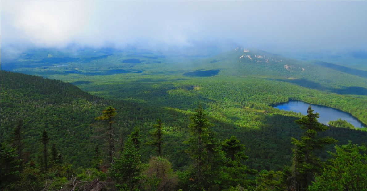
It was a great hike up and after 2.8 miles we reached the summit. Sure enough the low cloud cover was obscuring the views. But while we were taking a break the clouds started lifting and the views were opening up. Sawyer Pond was far below and Green's Cliff was just beyond that. To the south was Owl's Cliff, our next destination.
Overgrown trail to Owl's Cliff
Moose country
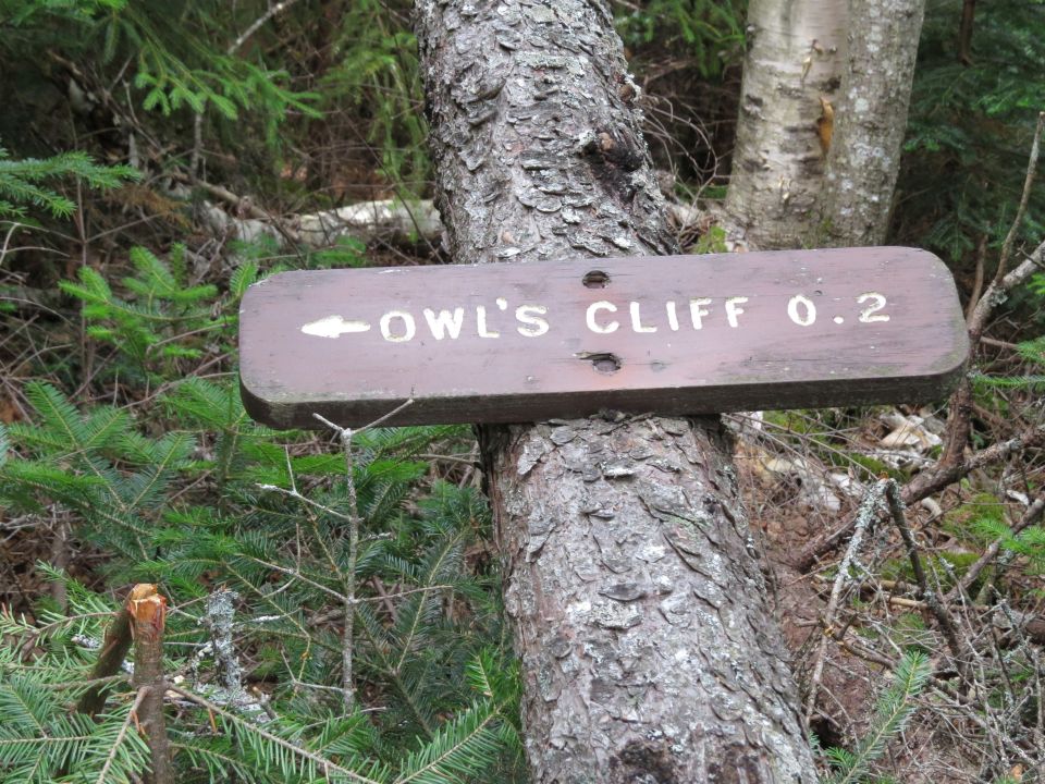
We continued our hike and started the descent of the Brunel Trail to Owl's Cliff. This trail is on the south side of Mount Tremont and gets right down to the business of going down. It is a very steep trail and with every step down I was thinking about the steep step up on the return trip. As the trail leveled out at the bottom it was apparent that this is an area that doesn't get a lot of use. Some areas are overgrown and the trail can be difficult to follow but we found our way without too much trouble.
Owl's Cliff outlook
Green's Cliff
We got to the spur path junction and noticed the sign indicates 1.3 miles to Mount Tremont and the maps show 0.8, not sure which is correct but it felt like 1.3 on the way back. Following the spur path we were soon on the edge of a steep ledge that went down and out of sight. There is a nice outlook with views to the south and southwest.
View from Owl's Cliff
Looking down the ledge on Owl's Cliff
Closer look at Green's Cliff
Brian and Jill heading back up the steep trail to Mount Tremont
After a short break we started our return hike. It was not long before we arrived at the bottom of the steep climb back up to the summit of Mount Tremont. Every step was earned as we made our way up but for some reason it didn't seem to take long. The clouds had lifted and we took some final photos before descending the Mount Tremont Trail. There were a few sprinkles as we started back down.
Caves
Looking back at Owl's Cliff
About half-way down we met our first and only hiker of the day on her way up. As we moved on down the trail the rain picked up but there was never a soaking downpour and it was hardly noticeable given the amount of sweat that I was already soaked in. One last stop for a waterfall photo and we were soon back at the trailhead.
Enjoying the view from Mount Tremont
Carrigain Notch
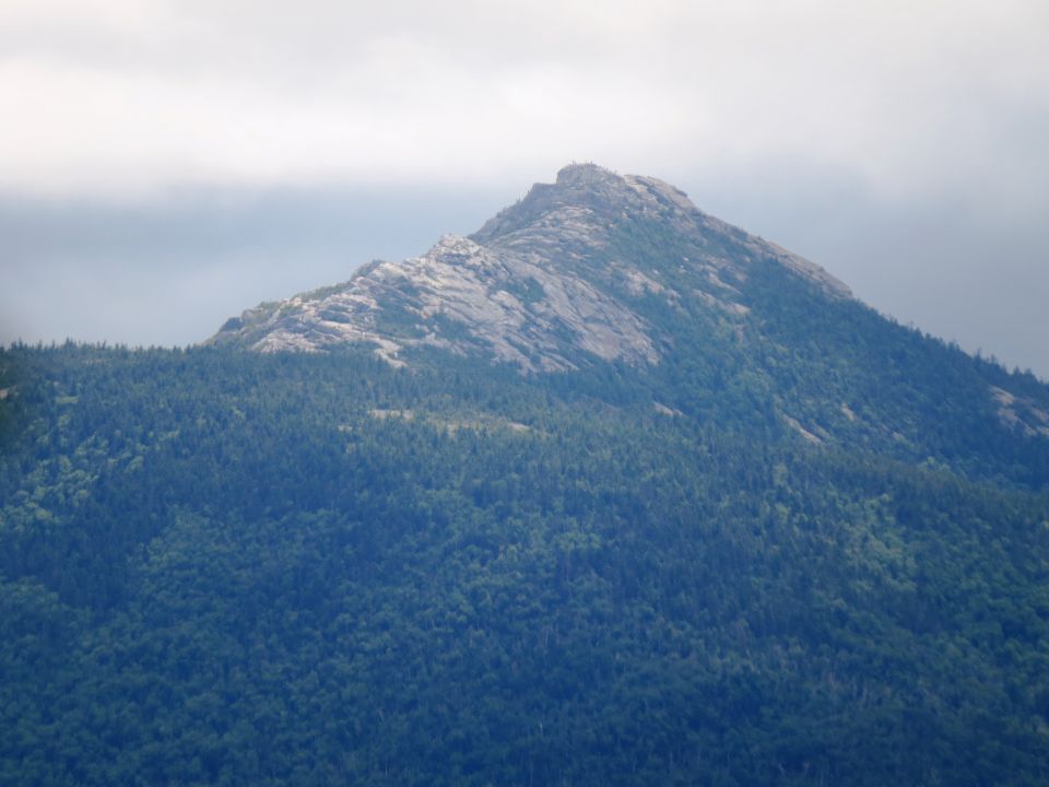
Mount Chocorua
Lots of hikers on the summit of Chocorua
For such a relatively short hike (7.6 miles) it presented a good challenge with the steep descent and return ascent. I considered it a good prep for the Glen Boulder route to Mount Isolation. Both have similar approaches, an up then down with a short ascent to the summit, it's then a short descent then an ascent then down again. Of course Isolation is a bit longer but the steep trail on Mount Tremont provided a good workout.
Final shot of Sawyer Pond and Green's Cliff
The decision to postpone the hike to Mount Isolation was a good one and this hike today was a great alternative timed perfectly for some spectacular views. While the initial plan was to hike just Mount Tremont I suggested hiking on to Owl's Cliff. We all agreed that this was an enjoyable hike on a trail less traveled. Now on to Isolation!
Having Fun in the Great Outdoors!


No comments:
Post a Comment