


After feeling "under the weather" yesterday I was not on my "A-game" today. But it was such a beautiful day that I had to get out and hike somewhere. So after sleeping in this morning I found the perfect hike for today. Back in March I hiked the Sugarloafs off of Zealand Road. The plan for today was to hike Sugarloaf Mountain deep in the Nash Stream Forest via the Sugarloaf Mountain Trail.

The greeting at Nash Stream Road

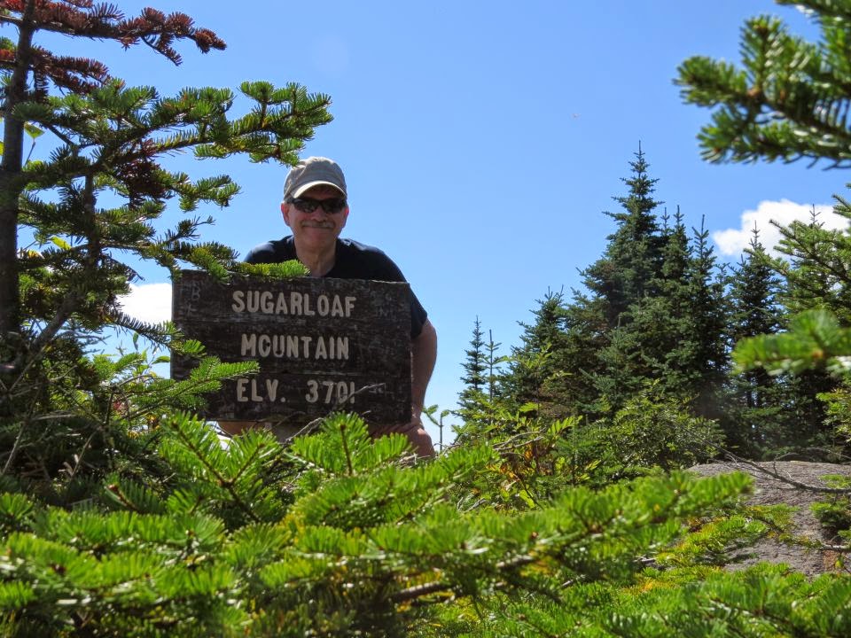
Sugarloaf Mountain

I couldn't find the phone


A fork in the trail


Easy-under blowdown

Walk-around blowdown


Clearing at the old fire warden's cabin remains

Remains of the fire warden's cabin

Spring


This trail is a steady, gradual climb to the summit, keyword being steady. After not feeling well yesterday I found myself resting more than usual and drinking lots of water. It was warm but there was an ocassional cool breeze blowing and it felt good.


I came up to a clearing and this is where the remnants of the fire warden's cabin can be found. To the left of the clearing is an old spring. There is heavy growth along this section of trail but it soon goes back into the woods and it's clear hiking from here to the summit.


Summit


It was along the upper part of the trail that I met fellow hiker Jack. I recognized him from his Facebook posts. He would be the only hiker that I would see today. We talked for a few minutes then went our separate ways, he was descending and I continued my ascent.

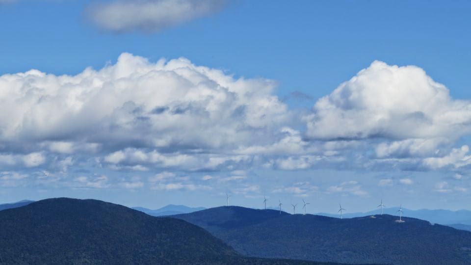


The summit was close and I was soon standing on top. The views to the north, south and east were spectacular! There were no clear views to the west. I spent some time taking photos, eating and resting. After a half hour I felt revived and ready to make my descent.


Asters


It was a quick trip back down. As steady as it was going up it was just as steady going back down. The ascent took me 1:30 and the descent was 45 minutes. For anyone looking for a remote, solo hike with no crowds this is the one. Although a short hike it would be a very long walk out if there was a dead car battery waiting at the trailhead. I did not see or pass any other cars for over 5 miles as I drove back out on Nash Stream Road.

Appropriately named cabin

North Percy Peak

Nash Stream

A look back at Sugarloaf Mountain
Final ascent to the summit
Panoramic view from Sugarloaf Mountain
Having Fun in the Great Outdoors!
No comments:
Post a Comment