A cold front last night brought snow to the high peaks. Cold, crisp and clear was the forecast for today. As we set out for the trailhead temps were in the 20's - wind chill was colder! Today's hike would take us up the 19 Mile Brook Trail to Mount Hight via the Carter Dome Trail then over to Carter Dome along the Carter-Moriah Trail and down to Carter Notch Hut. The return trip to the trailhead would be down the 19 Mile Brook Trail. This hike was 10.4 miles long and included a 4,000 footer, Carter Dome (4,832').
 |
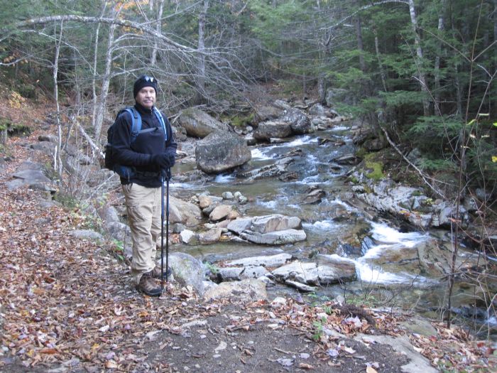
Cold start at the Trailhead
|
 |
19 Mile Brook
|
 |
19 Mile Brook Trail
|
 |
First icicles
|
This is another very popular trailhead but being early in the morning there was still plenty of parking available. As we pulled in others were also arriving. The air was crisp and cold with a slight breeze blowing. The sky was clear with the exception of clouds hovering over the highest peaks and the sun was rising but still behind the mountains. We put on some layers, hat, gloves, backpack and started up the 19 Mile Brook Trail.
 |
More icicles
|
 |
First snow
|
 |
Snow-laden pine bough
|
 |
Snow and ice
|
It was a beautiful morning on the trail that follows the 19 Mile Brook. Started seeing the first icicles hanging off of logs over the brook, last night was cold. We made our way up to the first trail junction and veered left onto the Carter Dome Trail. Halfway up this trail we ran into spotty snow that eventually led to a snowy and icy path that required using some caution in places. There was never more than a couple inches of snow throughout the rest of today's hike.
 |
Icy trail
|
 |
More ice on the trail
|
 |
Carter Dome 1.2 mi.
|
 |
Carter Dome 1.5 mi.
|
We came to another trail junction with two somewhat confusing signs. These two signs faced each other and were about ten feet apart. One sign had Carter Dome at 1.2 miles and the other 1.5 miles. A quick look at the map straightened this out. We were at Zeta Pass and both the Carter Dome Trail and Carter-Moriah Trail converge here. Carter Dome Trail bypasses Mount Hight and is shorter. The Carter-Moriah Trail goes to the summit of Mount Hight and is well worth the extra 0.3 mi. of hiking.
 |
Snowy trail
|
 |
First view ascending Mt. Hight
|
 |
Summit of Mt. Hight
|
 |
Carter Dome from Mt. Hight
|
The climb to the summit of Mount Hight was somewhat steep and strenuous with the snow and ice making it a slow cautious ascent. A cold wind was really starting to pick up. Views were opening up through the trees. We reached the summit and the 360 degree view was fantastic! Looking across to the Presidential Range provided a scenic vista of snow-capped peaks. We took several photos and moved on to Carter Dome.
 |
Presidentials from Mt. Hight
|
 |
Southern view from Mt. Hight
|
 |
More signs
|
 |
Northwest view from Mt. Hight
|
As we moved down into the trees we were able to get out of the wind. The trail became very narrow and around one bend in the path I came face to face with a pit bull mix. He stood there staring me down. The owner came right along and I moved into the bushes to make room for them to pass. The dog stood there and I was told that he was afraid of the trekking poles so I hid them behind me. With much coaxing the dog finally passed by and we all went on our way.
 |
Mount Washington
|
 |
View from Carter Dome
|
 |
Carter Dome summit
|
 |
Carter Dome summit signs
|
We arrived at the summit of Carter Dome. Not much of a view from this peak. There was one opening in the trees looking north. A group of hikers asked if I would take their picture, I did, and in return they took ours. A few more pics of the summit and we made our way down the trail to Carter Notch Hut. This is a steady descent and gets very steep toward the bottom.
 |
Descending Carter-Moriah Trail
|
 |
View across Carter Notch
|
 |
Carter Notch Hut far below
|
A stiff breeze was blowing as we made our way between the lakes and up to the hut. There were several people in the hut but soon left and we had the place to ourselves for a few minutes before the next hikers around. Being inside was a nice break from the wind. We had some lunch and relaxed. The temperature outside was 35 degrees, inside was 41 degrees.
 |
View east from through Carter Notch
|
 |
Relaxing at Carter Notch Hut
|
One of the hut caretakers returned. This time of year and throughout the winter the hut is open for berthing but no meals. Life has got to be tough up here in the winter, there has to be some very cold days and nights. We finished eating, packed up and prepared to make our return trip to the trailhead parking lot.
 |
View of Wildcat Mt.
|
 |
Wildcat Mt. from Carter Lake
|
Stepping out of the hut we were met with a cold wind. It's a quick ascent up from the Carter Lakes to the junction of Wildcat Ridge and 19 Mile Brook Trails then all downhill from there.
 |
Reflecting pool
|
This is a hike that I have been wanting to do and was waiting for the right day. Today was perfect with nice cold temps and spectacular views. Carter Dome is #10 on our quest to hike New Hampshire's 48 4,000 footers!
Having Fun in the Great Outdoors!


No comments:
Post a Comment