

Summits: Mount Jefferson (5,716'), Mount Washington (6,288'), Mount Monroe (5,372')
Trail route: Jewel Trail, Boundary Line Trail, Jefferson Notch Road, Caps Ridge Trail, Gulfside Trail, Crawford Path, Ammonoosuc Ravine Trail, Base Road
Trail conditions: Mostly dry ground but with avariety of mud, wet, unstable monorail and deep soft snow along the way
Weather: Cool morning temps warming up with sunshine to cool gray overcast once past the wilderness boundary then back to sunshine and warm temps on the way out
Total miles: 12.7
Total time: 11 hours
Weather and trail conditions were looking good for a hike above treeline over several Presidential summits. There was sunshine and warmer temps with light wind in the forecast and possible late day showers. After checking the trail reports I was expecting the only significant snow to be on our descent of the Ammonoosuc Ravine Trail. I would be hiking with Jill, Guy, Melissa, Scott and Lisa. After reaching the summit of Mount Jefferson Guy and Melissa would be leaving the group to hike Mount Adams and Mount Madison.
On my way to the trailhead I picked up Guy and Melissa at the Appalachia parking lot so they could spot a car. We then drove to the Ammonoosuc Ravine Trailhead parking lot and met up with the rest of our group. We were on the trail just after 7:00 AM. The Jefferson Notch Road was still closed so we would be hiking across Boundary Line Trail onto the Jefferson Notch Road and up to the Caps Ridge Trail.
The Boundary Line Trail was wet and muddy. The Jefferson Notch Road appeared to be in good condition at least the section we were walking. We then arrived at the empty Caps Ridge Trail parking lot. The trail was in good condition with just a few insignificant patches of snow. We made our way up over the Caps without any problem and onward to the summit.
There was a cool breeze on the summit of Mount Jefferson. After a few photos we moved down below the summit and had something to eat. It was a great spot for basking in the sun but there was many more miles of hiking and we could not linger long. This is where Guy and Melissa split from the group and started their hike to Mount Adams and Mount Madison. The rest of us went in the opposite direction heading for Mount Washington and Mount Monroe.
It was a warm hike across the Gulfside Trail. As we went by the top of the Great Gulf there was a snow chute that went all the way to the bottom of the gulf. Skiers and snowboarders were taking advantage of this snow and it was almost a vertical drop. It was amazing that anyone could ski or ride down this chute. I'm a good skier but I can't even imagine skiing down this slope.
We were seeing many people by this point as we were getting closer to the summit of Mount Washington. There was a lot of tourists that had either driven up or taken the cog train and walking down the hiking trails. When we got to the summit there was a long line at the summit sign. We chose not to wait in line and took our group photo in another spot. We took a short break before moving on to our next summit.
As we descended Mount Washington there was still a lot of people on the trail. It was a nice hike over to the Lakes of the Clouds hut. The hut was opened for cleaning but not for business. We dropped our packs and started our ascent on Mount Monroe. It was a quick hike up and down. I knew there was going to be snow down below on the Amonoosuc Ravine Trail so I put my gaiters on and got my microspikes out.
It wasn't long before we got into the snow and the microspikes went on. There were sections that we had to walk carefully. I was seeing some very deep postholes and some areas had flowing water underneath the snowpack where we were walking. It was a slow, careful hike with unconsolidated snow, wet ledges and water crossings. We got down past the snow where we could remove our microspikes. Past Gem Pool there was still some sections of snow but traction was not needed.
Instead of continuing down the trail to the parking lot we came out at Marshfield Station and did the road walk. We had enough of stepping on rocks and roots for today and preferred the smoothness of the roadway. After 11 hours we arrived back at the parking lot to complete the loop from where we started. It was good timing as a light rain started to fall.
On my way back home as I was approaching the Appalchia parking lot I saw Guy and Melissa just about to leave. I was surprised to see them as I thought they would've been long gone by now. I stopped and spoke to Guy for a few minutes. He said they had bypassed Mount Adams and only did Mount Madison.
The weather and trail conditions were as I expected. It was a spectacular day for a hike above treeline and I was glad to be able to hike these three summits on such a beautiful day with some great hiking friends!
Enjoy the photos and videos!

Sunrise over an undercast on the drive to the hike

Easy water crossing to start the hike

Clay Brook

Turning onto the Boundary Line Trail

Painted trillium

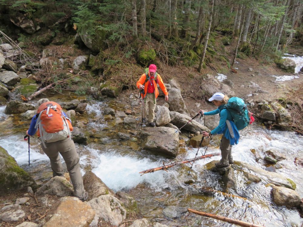
Good water flow but rock hoppable

Using different spots to cross this brook

On the Jefferson Notch Road

Almost to the trailhead parking lot

An empty Caps Ridge Trail parking lot

Jill trying to figure out what this pipe is doing here

Caps Ridge trailhead


Mushroom

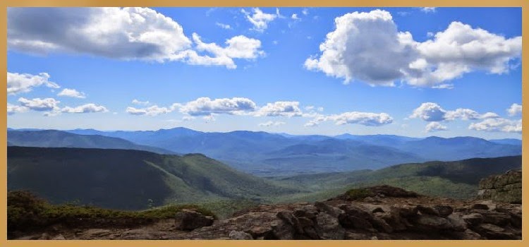
A good outlook to view the summits we'll be hiking


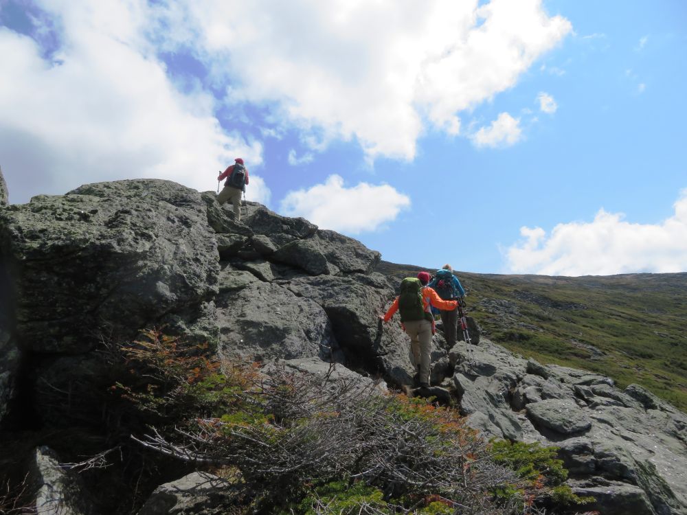
Heading straight up the first Cap

More Cap climbing

Scott and Jill on a Cap
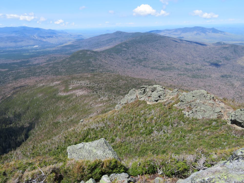
A look back down from where we came
On the last Cap

Summit up ahead


A look back down

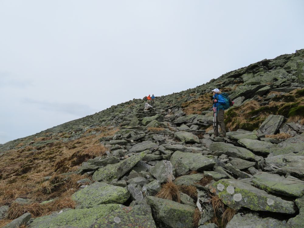
Final push to the summit of Mount Jefferson

There's the summit

A view of Mount Washington from the Mount Jefferson summit

Melissa and Guy head to Mount Adam and Mount Madison

A look up at the pile of rocks that make up the summit of Mount Jefferson

Descending Jefferson on our way to Washington

A look back at Mount Jefferson

Snow fields on Mount Clay

On the Gulfside Trail


Sphinx Trail

Putting some distance between us and Jefferson

Cog train going up

Walking along the top of the Great Gulf

Looking into the Great Gulf

Spaulding Lake

Jill standing on the edge of the Great Gulf

Skiers and snowboarders were skiing and riding down this slope into the Great Gulf

Snowboarders can be seen far below

Snowboarders at the bottom of the Great Gulf after riding down
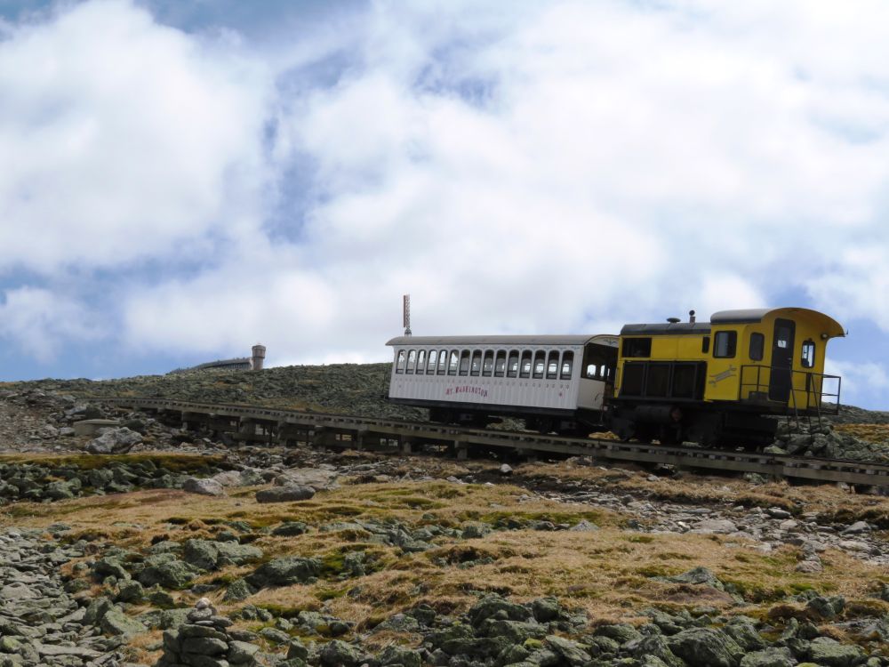
Cog train descending

Another cog train starting its descent


Cog train about to drop over the edge

Crossing the cog tracks

Mount Washington summit

Line at the summit sign

Descending Mount Washington and on the way to Mount Monroe

Our next summit is in sight
Descending Mount Washington

Carefully crossing a slippery snowfield

Half frozen lake just before the hut

A short walk through the snow beside the lake

Lakes of the Clouds Hut just ahead

Dropped our packs at the hut and on the way up Mount Monroe

Approaching the summit of Mount Monroe

Mount Washington from the summit of Mount Monroe

Lisa and Scott enjoying the summit views

Jill happy to be on the summit of Mount Monroe

Lots of cleaning going on inside the hut

Cog train crossing Jacob's Ladder

Carrying a propeller up to the hut...don't know what that's all about

Some real sketchy hiking with water flowing underneath the soft snowpack

Water flowing out from under the snowpack

Wet ledges to climb down

Water crossing

Water flowing over ledge

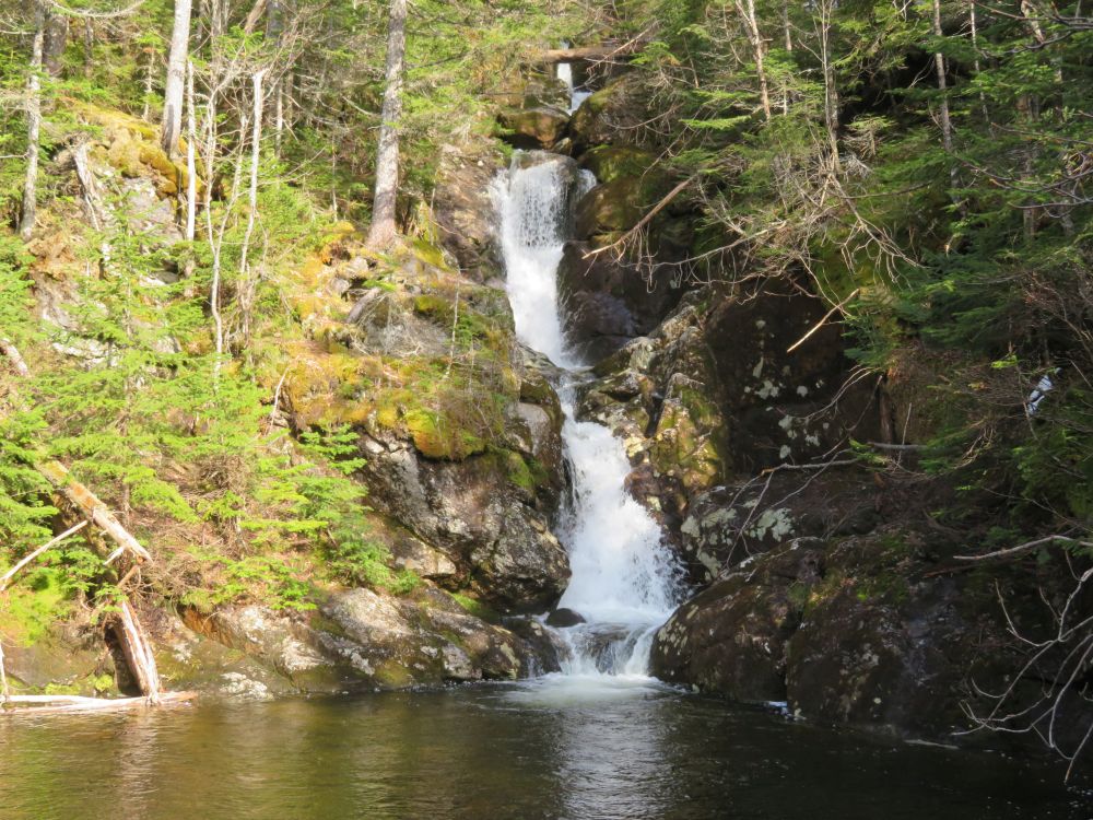
Series of waterfalls

Descending a steep and slippery section of snow

Slow and careful without any mishaps

Twin waterfalls

Scott stops for a photo
Gem Pool

Crossing Gem Pool

This old bridge is still hanging in there

Ammonoosuc River
One final water crossing

More snow

Blowdown debris on the river

We had enough roots and rocks for the day so took the shorter trail to Marshfield Station

Leaving the trail at Marshfield Station

After 11 hours we're back where we started
Having Fun in the Great Outdoors!
No comments:
Post a Comment