

The humidity of recent days was gone and spectacular weather was in the forecast for this Fourth of July. It appeared to be a great day to hike Mount Moosilauke (4,802'). My route would take me up the Gorge Brook Trail to the summit then over to South Peak and down the Carriage Road to the Snapper Trail back over to the Gorge Brook trail completing the loop and back down to the trailhead.
I packed up the car and was on my way before sunup. The sky was clear and the air was cool. Some of the high summits had a few wisps of clouds while some were completely covered otherwise there was plenty of blue sky above. I drove up to the designated hiker parking on Ravine Lodge Road and was the third vehicle there. I was expecting a lot more but it was still early.
I put on my pack and was on my way up the dirt road toward Ravine Lodge. I arrived at the lodge to find there is still quite a bit of work left to be done on the new lodge. I dropped down the road to the beginning of the trail and was glad to see the water level was down on the Baker River. Even though there is a bridge here it was good to see the water had dropped from the flooding rains of last weekend and that would be the case for all water crossings today although most have bridges.
Hiking up the Gorge Brook Trail was very pleasant with a nice, cool breeze blowing. The trail was drying out nicely from the recent rain and there was only a few insignificant patches of mud that were easily avoidable. I was surprised to see quite a few hikers coming down the trail. They had gotten a very early start expecting to maybe catch the sunrise but they all told me that the summit was completely clouded in. The summit looked clear to me from down below but as I climbed higher I could see clouds moving across.
When I got up to the more exposed areas of the trail it was getting much cooler. In the last section of trees before reaching the completely exposed summit cone I added a fleece layer. As I was doing this a hiker came up behind me and told me he had just seen something he hadn't seen in five years of hiking...a bear! He said a small bear stepped out onto the trail and they were face-to-face for a moment. The bear quickly moved into the brush and he continued on his way. I never did see a bear today and that's all right by me.
I arrived at the summit and there were other hikers already there. I would not be alone on the summit today as there were hikers constantly coming and going from every direction. There was a good stiff wind blowing and I was glad that I had brought my fleece, a last minute addition to my pack this morning. Not bad when moving but very cool when standing around taking photos. After a brief break I continued my hike toward South Peak.
I was now on the Carriage Road. There is a spur path to the summit of South Peak with a sign that indicated 1/10 of a mile, it felt a little longer than that. Up on the exposed summit of South Peak I was back in the wind again. There was some more great views from this summit. After some pics and a video I started my descent and it would be all downhill from here.
There were many hikers coming up as I went down. It was starting to get very warm and the black flies were coming out but not bad if I kept moving. Lower down on the Carriage Road there were several young people doing trail maintenance, very hard work. I had never been on this trail and as I got further down I was wondering if I had missed the Snapper Trail. Not possible, I found that the turnoff to this trail is well marked and quite obvious. I was soon on my way over to the Gorge Brook Trail.
The Snapper Trail is a very easy and pleasant hike. I arrived at the Gorge Brook Trail completing the loop over Moosilauke and South Peak. It was a short trip back down to the trailhead. Then there was the road walk past the new lodge and back to the hiker parking area. There were many vehicles parked there and the line stretched down the road, I counted 45 on the drive out.
Two hikers that parked beside me were just leaving for their hike. I was a little concerned as they did not know the names of the trails to reach Moosilauke and did not have a map. Their GPS was giving them the name of a trail that was nowhere around here. One of them took a photo of my map of the Moosilauke area and trails with their phone. I hope they had no problems as they would not be getting back down until the evening.
This was my third hike to Mount Moosilauke and my first time doing the loop over to South Peak. The previous two times were in snow. Having bare trails free of snow and ice made this a completely different hike to the summit of Mount Moosilauke. The same prevailing wind that always seems to blow up there was present today but not nearly as strong as my past visits. With comfortable temps, great views, and good trail conditions this was an ideal hike for the Fourth of July!
Enjoy the many photos from this hike!

Passing by Madison and Adams on the drive to the trailhead

Tall Meadow Rue

After a road walk the hike starts here

Crossing the Baker River

Baker River


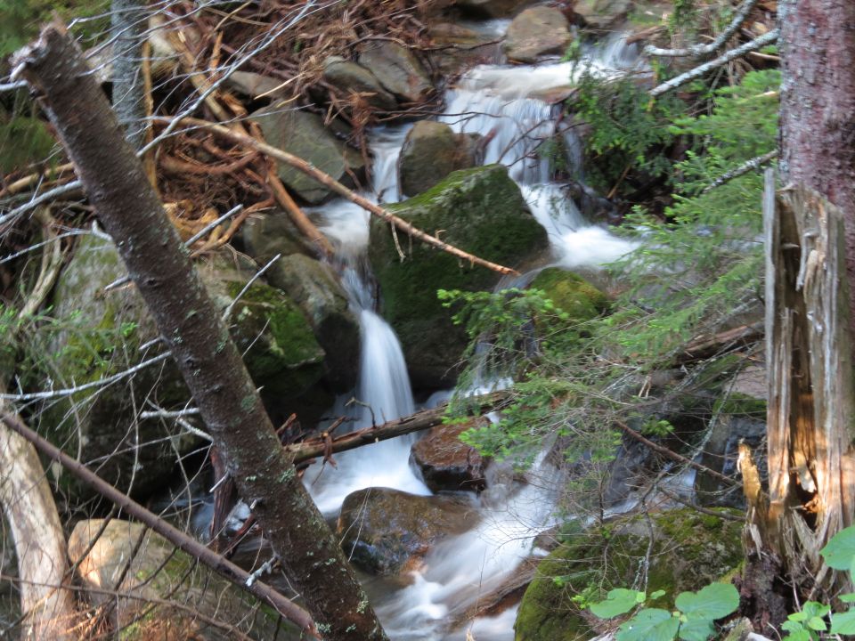
Gorge Brook

Heading up Gorge Brook Trail and returning via Snapper Trail


Another bridge

Gorge Brook

Damaged trail

Rock bridge over a small brook


First view from the Gorge Brook Trail

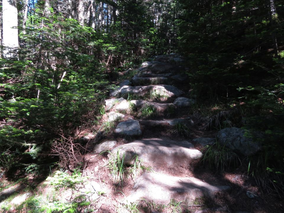
Rock steps


Blue-bead lily in bloom


Lots of blooming bunchberry along the trails today

Ravine Lodge far below where the hike begins

Zooming in on Ravine Lodge from far up on Mount Moosilauke

A bear was seen here by a hiker just minutes after I passed by

The summit is up ahead

Mountain Sandwort

A look back

Getting closer to the summit

South Peak

Almost to the summit

Looking back down the trail from the summit

On the windy summit of Mount Moosilauke


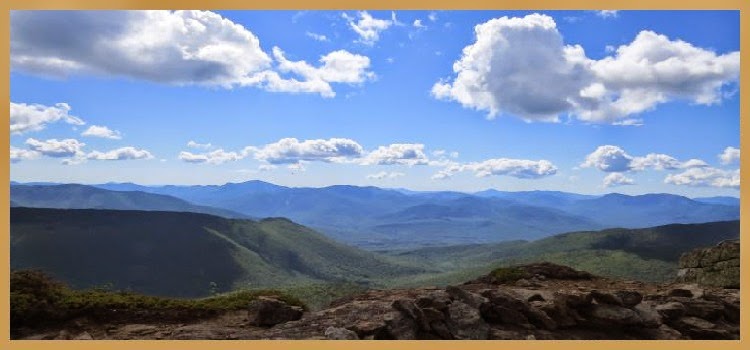
Beautiful views from the summit

South Peak in the distance


Lots of cairns on the way to South Peak


A view to the south


More bunchberries blooming along the trail

Looking back at Mount Moosilauke


A nice smooth section of the Carriage Road

South Peak up ahead

Mount Moosilauke from the Carriage Road

Mud Pond

Carriage Road can be seen slicing down through the woods

Standing on South Peak

South Peak summit cairn

Zooming in on hikers on the summit of Mount Moosilauke

Descending the spur trail from South Peak to the Carriage Road

Felt more like 2/10 of a mile


Carriage Road boulder gate

Continuing down the Carriage Road


White admiral butterfly far up in a tree


Turning onto the Snapper Trail

Blue-bead lily before it turns blue

On the Snapper Trail

This bridge is not needed...but I used it

Easy water crossing


The loop is complete


Back at the bridge where the hike began

The new Ravine Lodge being built

Road walk

Franconia Ridge in the distance
Having Fun in the Great Outdoors!
No comments:
Post a Comment