

With sunshine and warm temps forecast for today I was anxious to get out on the hiking trail. So early to rise and I was on my way to the trailhead at 5:00 am. Today's hike would take me up the Garfield Trail to Mount Garfield, another 4,000 footer that I could add to my completion list.

Sunrise on the drive to the trailhead

Cloud-capped Presidentials

Trailhead

Blowdown

Easy under

Furled ferns

Sunlight through the forest mist


Two-tenths of a mile to the summit from here


Reaching the Garfield Ridge Trail I met three more hikers on their way to the summit of Garfield. I followed them up the last two-tenths of a mile. This was the steepest part of today's hike but it wasn't too bad. I reached the summit and was rewarded with some spectacular, unobscured 360 degree views.


South view

North view

East view


Summit of Cannon Mountain

Galehead Hut


As I made my way down I was surprised at the number of hikers making their way up to the summit. There was also a lot of dogs enjoying the trail today. I had no idea Mount Garfield was so popular, but now I know why. The Garfield Trail makes a gradual ascent to the summit and is well protected in the event of inclement weather. Its bare, granite summit provides a scenic panorama that includes a spectacular view into the Pemigewasset Wilderness.


Hobblebush

Painted Trillium

Big mushroom


Blowdown that didn't fall across the trail


Watching the parade of hikers

A last look at Owl's Head in the Pemigewasset Wilderness

Mount Garfield
Book time for this hike to the summit of Mount Garfield is four hours. The trail was in good condition, it took me three hours up and two hours and fifteen minutes down. With an elevation of 4,500 feet Mount Garfield was #26 for me on my quest to complete the 4,000 footers. This was an awesome hike and I'm going to add it to my favorite hiking trails!
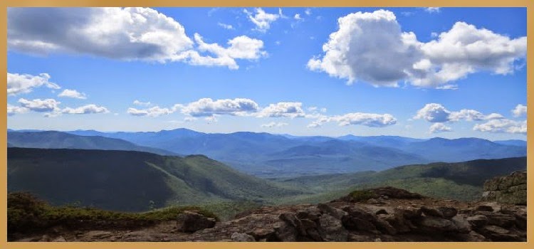
Panoramic view from the summit of Mount Garfield
Having Fun in the Great Outdoors!
No comments:
Post a Comment