

I postponed my hike one day because of the weather. Hurricaine force winds blasted the summits on Saturday leaving gusty winds today but very tolerable. My plan for today was to do a loop hike around Huntington and Tuckerman Ravines continuing over the Gulf of Slides. I would start from Pinkham Notch using the Old Jackson Road to the Nelson Crag Trail across the Alpine Garden Trail up a little section of the Tuckerman Ravine Trail turning onto the Lawn Cutoff over to the Davis Path down the Glen Boulder Trail and finally across the Direttissma Trail and back to the Pinkham Notch Parking area.

Sun rising

Summits in the clouds

Sun coming up over Wildcat

First waterfall

George's Gorge Trail junction with sun peering through

Light at the end of the boardwalk

Old Jackson Road takes a sharp left and goes up

Raymond Path trail junction

Nelson Crag Trail junction

Mount Washington Auto Road far below

Pinkham Notch looking south

A short break on the Nelson Crag Trail

Cairn in a blue sky

Cloud covered Mount Adams

Looking up at Nelson Crag


I passed the Raymond Path and the Nelson Crag Trail was 0.1 mile further. The Nelson Crag Trail passed through some nice woods and quickly started its uphill climb. There were a few spots that required hands as well as legs. As I climbed up past treeline the first views were fantastic. The sky was deep blue to the horizon.

Coming up on the auto road

Nelson Crag Trail meets the Auto Road


Looking down on the Auto Road

Enjoying the view!

Continuing up

Looking across the ravines

View from the top of Nelson Crag

I followed the cairn trail and was soon at the auto road. The Nelson Crag Trail actually touches the auto road then turns back in and up. I could watch the cars below as I was moving up the trail. As I got higher the wind picked up and the clouds were increasing but only on the highest summits. Everywhere else was sunshine.

Cairn on top of Nelson Crag

Alpine Garden Trail junction

Coming up on Huntington Ravine

View into Huntington Ravine

Huntington Ravine Trail junction


View into Tuckerman Ravine

Lion Head

Tuckerman Ravine Trail junction


Following the cairns to Boott Spur


Looking back on where I've been


Davis Path

It was downhill to the Alpine Garden Trail. The clouds were still above me and it was smooth going along this trail. There were only a few hikers along here and not as many as I would have expected on a nice day. As I passed Huntington Ravine Trail there was a small group of hikers just coming up over the edge. Not until I reached the Tuckerman Ravine Trail junction did I start seeing a steady stream of hikers. This trail of hikers went right up into the clouds covering Mount Washington. I was going in the other direction.

Glen Boulder Trail junction


Glen Boulder Trail


I was on and off the Tuckerman Ravine Trail in a matter of minutes using the Lawn Cutoff to reach the Davis Path. This took me past Boott Spur and down to the Glen Boulder Trail. There were a few hikers along here, some going to Madison Hut and others going to the summit of Mount Washington.


First view of Glen Boulder


The Glen Boulder Trail went through a small forest with a heavy growth of thick moss then back out to a treeless landscape. The views continued to be spectacular. I reached Glen Boulder, took a few pics and was on my way again. There was a nice view up into the Gulf of Slides.


Gulf of Slides


The last mile


Last waterfall of the day

Last look at Nelson Crag
Although Mount Washington remained in the clouds all day my path saw some overhead clouds and plenty of sunshine. It was a fantastic day and an awesome hike!
View from Davis Path
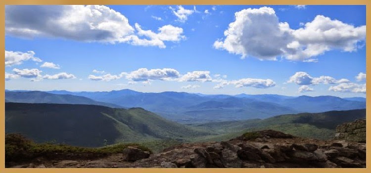
Scanning the ridge line that I hiked today
Having Fun in the Great Outdoors!
Hello! While this was a long time ago, do you remember your a actual mileage and hiking time? I’ve been thinking of doing this loop while it is warmer and light tomorrow or Saturday. thanks! Steve
ReplyDeleteIt seems like ~ 11 miles
ReplyDelete